Sunday, August 4, 2013

Waipio Valley

Waipio Valley OverlookI found a painting of a beautiful waterfall, and the Gallery Owner told me that it was Hi’ilawe Falls!

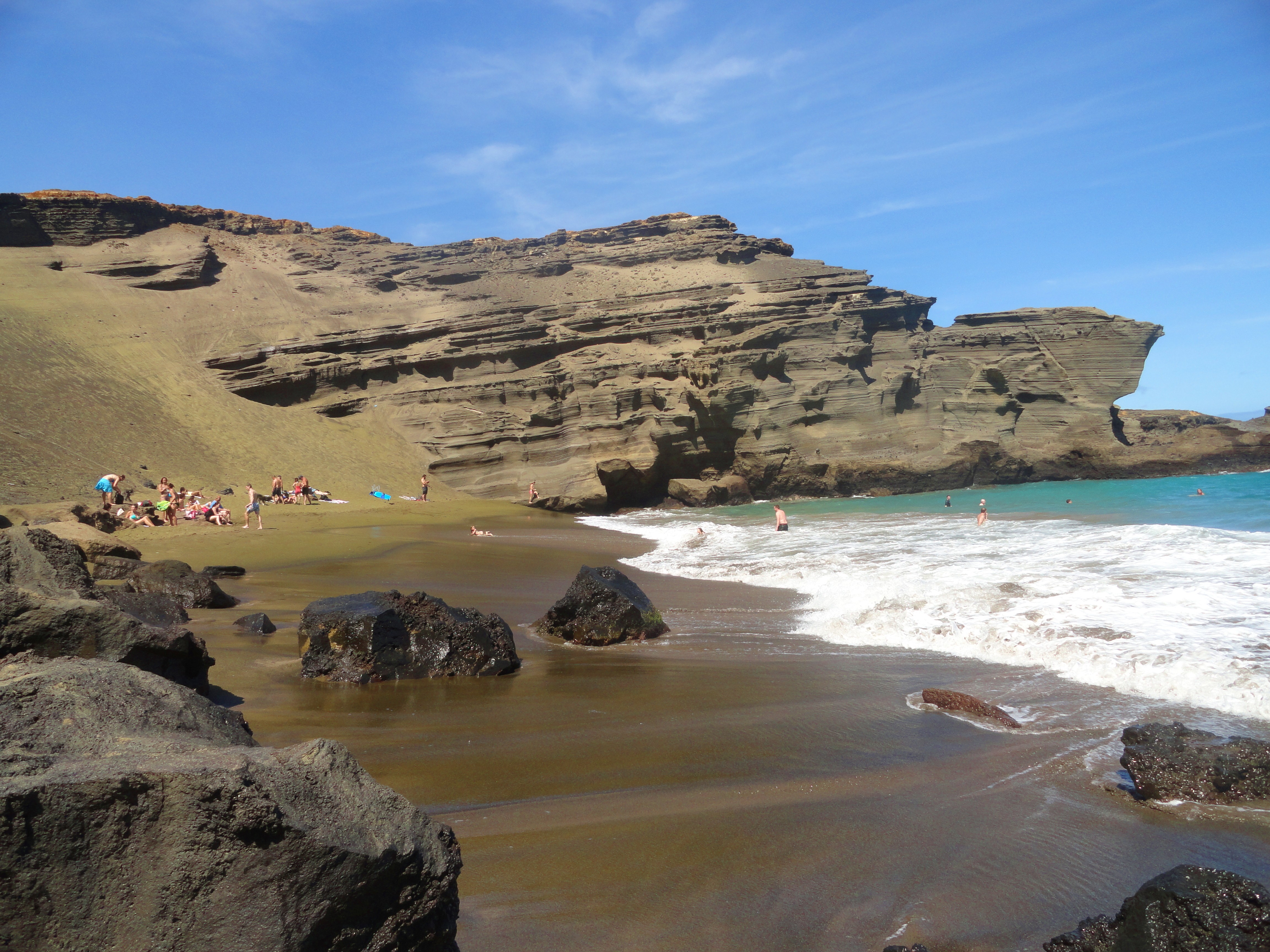
Hi’ilawe Stream empties into the Pacific Ocean right in Waipio Valley.
Waipio Valley is, in my opinion, THE most picturesque place on the entire Island!
You can see the most Amazing VIEW right from the top at the Overlook Point…which is the easiest option…
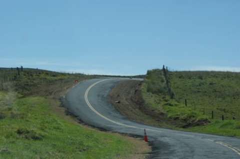
The steep cliffs are about 2000 feet (610 meters) above the Valley floor, so going IN to the Valley is complicated!
You can either:
Hi'ilawe River1) drive in – which is the scariest option! You are not allowed to take in a rental vehicle, and the vehicle must be a 4 wheel drive with low low low gear.
On your way down the hill, you must yield to upcoming traffic – if they have to shift, they can possibly roll off the cliff.  When you look over the edge of the cliff into the trees, you will see carcasses of vehicles that didn’t quite make it.   Also, don’t wear your seatbelt, in case you have to jump out!
When the road in is classified as “a road”, it is the steepest road of it’s length in the United States, and maybe even then entire world (says Wikipedia), gaining “800 vertical feet (243.84 m) in 0.6 miles (0.9 km) at a 25% average grade”.
2) take a tour, which will take you in by van, recreational vehicle, or donkey
3) make friends with a Local, who knows how to drive in AND/OR who is ok with abandoning their vehicle
4) hike – which isn’t as easy as it seems. It’s so steep, it’s recommended that if you do hike in, you leave enough recuperation time before you climb back out…
Wild HorsesWe  went in by “Local”.  My brother, who had been down into the Valley at least once, and who didn’t mind abandoning his vehicle – in fact, seemed like that’d be part of the great adventure!
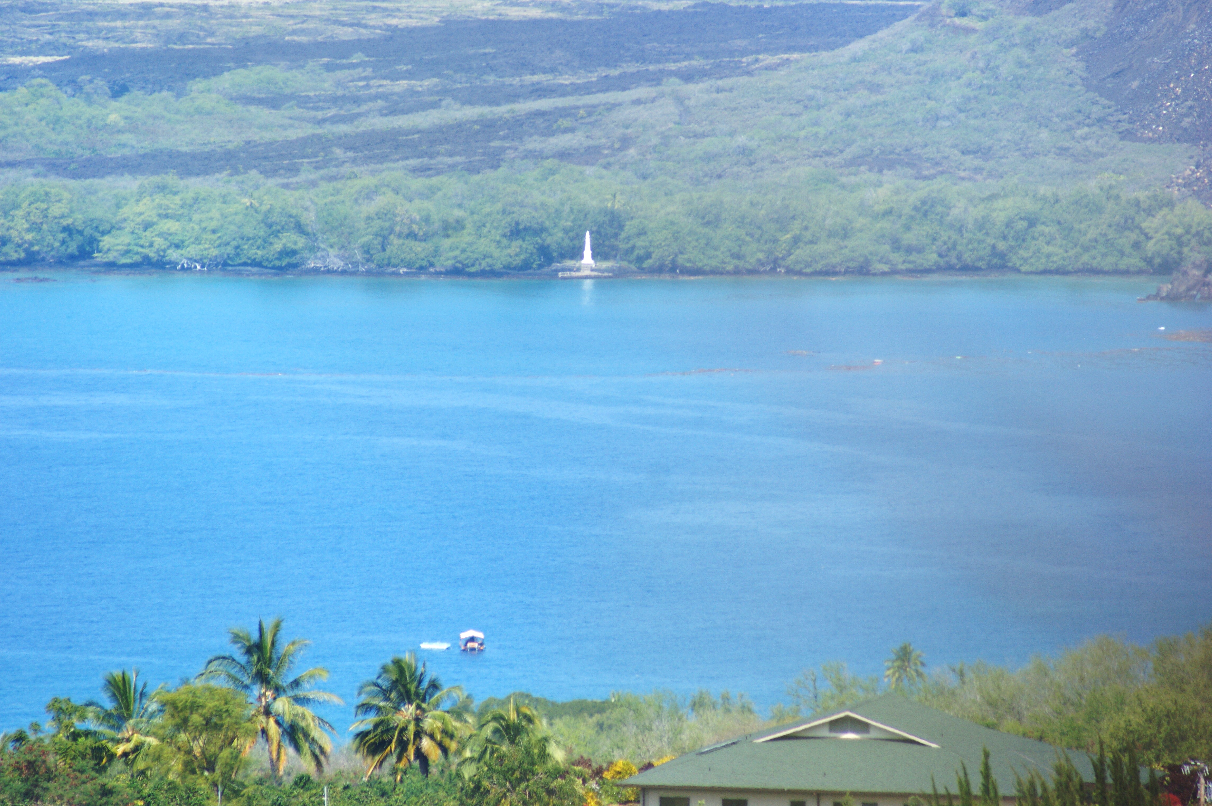
We arrived safely at the bottom of the Valley right where Hi’ilawe Stream empties into the Pacific Ocean, after meandering through the Valley, towards the Black Sand Beach at it’s mouth.  (On the way out, we were propped up in the bed of his little pick-up truck, and it’s seriously so steep, I was practically standing against the tailgate to keep from sliding out!  For us, that’s the only option.  There’s no way I’m hiking in.)
Tiny Girl in the Land of Giants
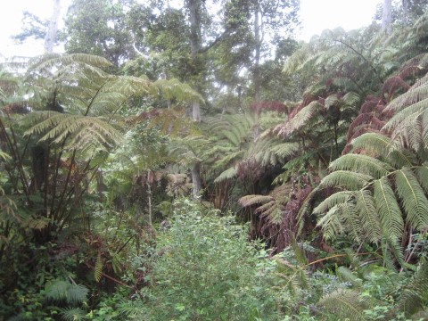
There, we were surrounded by gigantic trees, with “wild” horses grazing here and there - I say “wild” because I don’t think they are owned by anyone, but they have perfect manes, so I can’t be sure. (I was TOLD they were wild, though.)
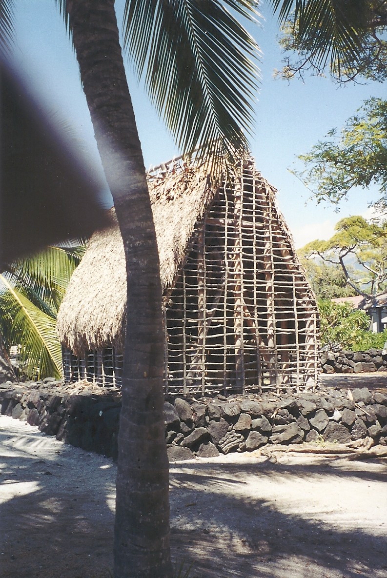
Waipio Valley is called “The Valley of the Kings” and was the home to King Kamehameha I and other royalty once upon a time.
Pink Mountain Apple?So, remember we wanted to find Hi’ilawe Falls, and didn’t realize there was a path, so we decided the best option was to go straight up the Hi’ilawe Stream.  (This was a good idea in theory, and worked out well – but some of the Locals were keeping an eye on us to make sure we were safe (we didn’t realize this until we were safely out of the canyon) because of flash-flood warnings…)
Anyway, for the most part, we were in the Stream and once in awhile, when it was too deep or the rocks were too big to climb over, we hiked right beside the River, through giant blades of grass (could be Ginger or something besides Grass, but I liked feeling like I was a tiny person in the Land of Giants), and over fairy-tale-like pink carpeting (which I’ve since learned was, I think, Mountain Apple (Hawaiian name is possibly ”Ohia’ai”).
It was a beautiful hike!
Hi'ilawe Falls 2Hi’ilawe Falls was impressive – it’s such a tall waterfall, it makes white capped waves when it hits it’s pool.  It’s two tiered and (apparently-reports vary) the first tier is in the 200 foot range, and the main tier drops 1400 feet!!  (Some reports say 1400 in total, and some say it’s 1600 in total… doesn’t seem like that should be that difficult to confirm…)
There’s a second (“twin”) waterfall called “Hakalaoa”, which dries up on occasion, but yay! for us! we got to see THREE waterfalls that day!
Either way, it’s REALLY magnificent!
Hi'ilawe FallsHi'ilawe Falls 3Hi'ilawe Falls 4
Next week, hopefully, back to Hilo.

Saturday, August 3, 2013

Hilo

Hilo Side LushnessOK. So, there is a big rivalry between Hilo-side of the Island and Kona-side of the Island.
If you ask a Kona-side person what they think of Hilo, they will typically say things like:  “It rains too much.”  ”They have coqui frogs.” ”There’s no place to surf/swim/snorkel.”
If you ask a Hilo-side person what they think of Kona, they will typically say things like: “Kona? Pfft.”
We love both sides for different reasons. I will talk more about why we love Kona later. (The primary reason is that we have really wonderful friends there, and that always makes a difference, doesn’t it.)
Rainbow FallsBut, some of the reasons that we LOVE LOVE LOVE Hilo side is that:

1) It rains. I don’t want to say “too much”, but it rains enough to make it lush and smell like a greenhouse. It has amazing waterfalls, vines, rainforests. And, I’m sure locals would tell me otherwise (they always do), but I haven’t seen it rain “too much”. The last time we were there (2 weeks), it rained every single morning – poured, actually. But, around noon, the sun came out and it go really warm, and then the next morning (or sometime throughout the night) the rain would come and cool down the earth again. For me, that’s perfect.

2) There are coqui frogs. I love them! I do! I’m sorry to all you coqui frog haters, but I love them! Sure, they are a little noisy (see previous blog), but if you think of them as “singing a song in chorus” rather than “screeching at 90 decibel”, I think you’d love them too! (and, if you can’t make them into “white noise” when you sleep, where earplugs and/or get a sound machine.)

3) There are MANY places to swim/snorkel/surf - they just are a bit off the beaten path and not near as crowded… (There’s more, too, than just that link I’ve included – they may or may not show up in my future blogs (or this one) but 1/2 the fun is finding these places by yourself.
Tom, the Chicken GuyBut the REAL reason I love Hilo-side, is because of the “Locals.”  “Locals” include actual Hawaiian people, as well as (by way of my definition) people who are not tourists.  “Tourists” (by way of my definition) are those people who are travelling (obviously) OR people who’ve moved there, but haven’t really become part of the culture yet.
For example, I consider Tom, the Chicken Guy, to be a “local.”  Or, a little boy we saw at the beach, who, it seems, lives outside, and looks exactly like I would imagine Tom Sawyer looked – white blonde hair, lightly tanned skin with freckles, and no shoes.
Here’s another difference I’ve observed between Kona-side and Hilo-side.  Kona-side, you can pick out tourists because they are pale(r) than the residence.  Hilo-side, you can pick out tourists because they are tan(ner) than the residence.  (Not because of the amount of time that the sun is available, but because the Hilo-side has an abundance of people who wear hats and avoid full exposure to the sun.  Lots of – ummm – organic people on the Hilo-side. Heh! I love it!)
Hawaiian Hilo HotelI will concede that there is more obviously touristy things to do on the Kona side (again, will discuss those later – if you are going to Kona before I get to that blog, please feel free to email me for suggestions), not including the most photographed waterfall in the world (in Hilo) and the longest erupting volcano in the world (south of Hilo at Hawaii Volcano National Park.)
There are very few hotels in Hilo, and the only one I’ve ever stayed at is the Hilo Hawaiian Hotel, right on Banyan Drive, and beside the Queen Liliuokalani Gardens. (We usually rent a Vacation Rental by Owner.
Babe Ruth's treeBanyan Drive is known as “Hilo Walk of Fame”, because the Banyan trees along the drive have all been planted by celebrities, including trees planted by Babe Ruth, Amelia Earhart, former U.S. Presidents Franklin D. Roosevelt & Richard Nixon, Dr. Thomas Jaggar, and others.  It’s an interesting walk, and just across the street is an ice cream and shave ice stand, so you can have a little break, too – especially if it’s hot out.
Queen Liliukalani GardenThe Queen Liliuokalani Gardens was named after Hawaii’s last reigning monarch, and dedicated in 1917, the same year the Queen died.  dedicated in 1917, the same year the Queen died.  (Her full name was Lydia Liliʻu Loloku Walania Wewehi Kamakaʻeha.)
The Garden is beautiful and last time we were there, we found a paintbrush in one of the trees.  You can just imagine someone spending the day, perched in a mango tree, painting the scenery below.  Perfect.
So…I have a LOT more to say about Hilo.  I haven’t really gotten started.. But, I have a tiny complication, which I will explain in a couple of weeks, so, I will have to return to this area later.  Hilo – to be continued…sometime.
In the meantime, next Sunday, I will be talking about some of the waterfalls.

Sunday, July 21, 2013

Holualoa, Cloud 9, and Saddle Road

Holualoa CafeWho wouldn’t LOVE to go for a Coffee and Art Stroll? Now that I know there IS one, I might plan an entire trip around it!
That’s one of the many things Holualoa has to offer – looks like the first Saturday of November. Apparently, each shop in town (which is almost certainly an art gallery of some sort, whether it’s paintings or woodwork or quilt-type things) hosts a coffee from one of the (more than) 30 Kona coffee farms.
It is a fun, quirky, cute little town (well, it’s not as “little” as I thought – apparently, according to the 2000 Census, there were over 6100 that lived there) – one of my two (maybe three) favorites on the Island (so far).
You can park and walk from end to end of the main street, stopping in at this Gallery or that Gallery, have a break at this coffee shop or that restaurant.
Cat Sleeping @ Kona HotelPink Hotel (Kona Hotel)
There’s an iconic pink hotel that completely represents the friendly, relaxed atmosphere of the town. We stopped in one time, to take a look around. There was nobody at the front desk. There was someone asleep in the rocking chair, watching the TV in the reception area, and a cat sleeping on the other rocking chair. (Nobody came, and we tiptoed out.) I didn’t take many pictures, but I’ve filed the memory away for safe keeping.
It’s better if you make an afternoon of visiting Holualoa - don’t rush through.
Right before you get into Holualoa Village (if you are coming from Kealakekua), you will pass a little wooden shop, Kimura Lauhala Shop , with a wooden boardwalk (at least that’s how I remember it), and filled with shoes and hats and bags made of Lauhala (pandanus leaf). The little shoes (slippahs) are very durable and I’ve had mine for years! (They even lasted through a teething puppy.)
Kimura Lauhala shop
We had the opportunity to talk with the ladies who make the hats (which, by the way, are very intricate and delicate – not just like a typical woven leafed hat), and their art has been handed down, from generation to generation. Unfortunately, they don’t have anyone to whom to hand down their art… :( (At least when we talked with them – maybe that has changed by now, hopefully.)
I didn’t buy a hat (or take pictures), but I have a couple sets of the slippahs.
Eucalyptus Trees at Intersection
Passing straight on through, and out the other side of Holualoa, you will go down a very scenic drive, with a very winding road through coffee plantations. If you go at the right time of day, you might even be able to stop at a shop or two along the way for samples.
Eventually, you come to an intersection where you can go down the hill to Kailua-Kona, or up the hill towards Waimea.
Be sure to take a look at the Painted (well, Rainbow) Eucalyptus trees there, before you proceed. My picture isn’t great (but it does show the particular Eucalyptus Grove…I’m including another picture I took in a different place on the Island, just so you can see how pretty they are!!) Apparently, they are the only Eucalyptus to grow in the Northern Hemisphere AND the most colorful trees in the world!
Eucalyptus Trees on the Big IslandWe are going up the hill towards Waimea.
Hiking the Cloud Forest
Just about a mile up the hill is the turn off, onto Kaloko Drive, to go to Cloud 9.
Really!
I don’t know exactly where, but you can get out and walk around in the Tropical Gardens of the Kona Cloud Forest. It’s a beautiful walk with moss-covered trees, and native tropical plants. Unlike a Rain Forest, which receives it’s precipitation from Rain, the Cloud forest receives 40% of it’s precipitation from – guess where! yep! Clouds & Mist!
Top of Cloud forestRoad up through the Cloud Forest
Pear CactusContinuing up the winding and fairly steep Kaloko Dr. (and perhaps Hao Street, says Google-maps), you will start passing addresses: Cloud #7, Cloud #8 – Cloud #9 (the ideal address), and on up! I forget how many “Clouds” there are, but it seems to me that we got to at least Cloud #14.
This grey cloudy picture is a view from the top of the Cloud Forest road, looking back down to the shoreline. I guess seeing the shoreline is rare since normally, it’s completely clouded in!
Down at the bottom the hill, and continuing uphill toward Waimea, you will probably be surprised by the scenery. It’s rolling hills and tall waving grass, and cattle ranches, and pear cactus! Yes, in Hawaii – cactus.
There’s also Hawaii-typical scenery, too - The Ocean, for example, and Cinder Cones.
After driving about 30 miles (from the Cloud Forest road), you will get to Saddle Road.
Once upon a time, rental cars were not allowed to take it – the road used to be TERRIBLE and the Pass is high altitude, and not very busy, so if you ever had any car trouble, you’d be stuck.
Old Saddle Road Old Saddle Road 1
NOW, the road is GREAT! And well travelled! It saves about an hour of travel time (at least) from the old route.
Saddle road
Up at the top of Saddle Road (well, it feels like the top – I think it’s actually sort of on the way down the other side), it’s completely barren. It looks like the lava just came through – almost nothing has grown back (probably the high altitude?) and is usally misty and eerie.

Then, suddenly, you emerge, and sometime after that (I always think it’s going to be 10 or 15 minutes, and then it feels like hours), you see the sparkling lights of Hilo, coming through the trees.
Next Sunday, Hilo.
(Normally, as some of you know, I post on Wednesdays and Sundays, but I have a project I need to work on, so, I’ll just be posting on Sundays until probably the end of August. I’ll keep you posted… heh.)

Wednesday, July 17, 2013

Kealekekua Bay and Captain Cook

Where the Ocean meets the SkyOnce upon a time, there was a brave sea-captain, name Captain James Cook.
Capt. Cook was born in Yorkshire, England in 1728, joined the British merchant navy in his teens and then joined the Royal Navy in 1755. He was an explorer, navigator and cartographer (his maps were so accurate that some of them were still being used in the middle of the 20th Century!)
He travelled the Globe, going here and there and everywhere, including, on his last voyage (apparently in search of the Northwest Passage): they went from Tahiti to Hawaii (he and his crew were the first Europeans to ever visit the Hawaiian Islands) to Cape Foulweather on the Oregon Coast (of the United States), which he named because – guess why – they had bad weather when they arrived…
Back to Hawaii (otherwise, why would I have it brought it up!) he first landed Hawaii (at Waimea, Kauai) sailing his ship, the Endeavor, in 1778.
The EndeavorIn 1999, we happened to be visiting in Kona when the replica of the Endeavor, a 3-mast sailing ship, was on its voyage. The replica was recreated using the Endeavor’s original plans that are stored at the National Maritime Museum in Greenwich, England. The replica was completing a 4 year, around-the-world tour, and though it was “new”, they made it so it looked weather-beaten.
Oh, you can “join a voyage” on the Endeavor, and learn to be part of the crew! Huh! (Shannan…I am NOT doing this! But, it does seem very interesting!)
We didn’t go onto the ship, but we did see it sail by from our 4 mast schooner. (Well, not “ours”, but the one that we borrowed.)
Captain Cook returned to Hawaii (this time in his ship, the Resolution, in 1779, and made landfall at Kealakekua Bay, on the Big Island. (“Kay-ala-kay-kua”, not “Kea-locka-kua” :D)
Apparently, he happened to arrive during the harvest festival, in which the Hawaiian’s worshipped their god Lono… And apparently, the ship mast had some sort of resemblance to something that had to do with the Hawaiian’s worship (not totally sure), so when they arrived, apparently, the Hawaiian’s mistook Capt. Cook as an incarnation of Lono…
Heiau at Kealakekua BayThey stayed a month, and during that time, “exploited the Hawaiian’s Good Will.”
After they left, one of the masts of the Resolution broke, and they had to return to Kealakekua Bay. It was an unexpected return, apparently the season of Lono was over, and the Hawaiians were UNhappy!
The details are random, but it goes something like this: Captain Cook and crew returned, quarrels broke out, someone took one of Captain Cook’s boats (a small cutter), Captain Cook tried to take King Kalani’opu’u hostage, the Hawaiians prevented that (big surprise), and Capt. Cook and crew had to retreat. As the Captain turned away, he was struck on the head and stabbed to death…
Or something like that.
Captain Cook MonumentAnyway – you can go to Kealakekua Bay – it’s BEAUTIFUL! and go visit Captain Cook’s Monument. (By the way, despite the final demise of Captain Cook, the Hawaiian chiefs still handled the Captain’s body the same way they would handle their own chiefs and elders (graphic description I’m skipping), and eventually, some of his remains were returned to the British for a burial at sea.)
You can either kayak, hike or boat to the monument, which is across the Bay from the easy-access road. The hike is reported to be strenuous – no problem going in, BUT 1300′ elevation increase in 1.8 miles on the way out.
The snorkeling in the area is supposed to be AMAZING!
Painted ChurchAlong the road from Hawaii Belt Road (Hwy 11) to Kealakekua Bay, keep your eyes out for the St. Benedict’s Painted Church. It was built in 1899, by the priest overseeing the parish – John Velghe. He had no formal training (painting, that is) and used house paint to paint the scenes depicted on the walls. The Church’s website tells that most of the Hawaiian people during that time didn’t read, so he used pictures to teach.
Painted Church, inside
Going North along Hawaii Belt Road, you come to Captain Cook (the town/village) and then Kealekekua.
I wanted to move there, just because I like the sound of the name :) . It’s a little town of about 1,650 people (as of the 2000 Census), is 1,427 ft (435 m) above sea level, nice warm temperatures without being too hot, and the subject of this major hit song from 1933, “My Little Grass Shack in Kealakekua, Hawaii.
We’ve been to a few nice, and quaint, restaurants there – let me see…one is the Aloha Angel Cafe (I’ve read reports that this might be close down…), and one is The Strawberry Patch, and I forget the other names – I Googled, but there are a few choices, and I’m not sure.. but if you are in town, spend some time there. (In the meantime, I will find out the names of the others.)
Another fun thing to do there is to visit the Kona Joe’s Coffee Plantation. You can go for lunch, samples and/or a tour. They are the world’s first “Trellised coffee plantation“.
Sunday, on to Holualoa, the Art District, and maybe Cloud 9.

“The man who wants to lead the orchestra must turn his back on the crowd.”
James Cook

Sunday, July 14, 2013

Place of Refuge, Punalu’u Bakery, and Mark Twain

Is this Heiau?Between Punalu’u Beach and South Point, you will pass through Naʻālehu. It’s a tiny little town of around 1000 people and one main street that runs through it.
TripAdvisor says “3 things to do in Naʻālehu. And, without looking, this is my list of 3 things to do there:
1) The Punalu’u Bakery - I would drive all the way to the other side of the Island for Punalu’u Bread, BUT now you can just buy it in the local grocery store. Still, it’s worth going to the actual bakery, which not only has the best bread EVER (along with samples) but just happens to be the southern most bakery in the United States.
Punaluu Bakery
You can buy purple (taro), pink (guava) or yellow/cream-colored (traditional) bread or swirled combinations. You can buy mixes to make your own at home later. (At the Maku’u Farmer’s Market, I had a Polish sausage on a Punalu’u Guava bun.)
It’s a bakery, so they also have cookies, and other desserts, but we really love the bread. (Oh, there’s also a quirky gift shop there, too.)
Shaka Restaurant2) Shaka Restaurant – it’s Claim-to-Fame is that it’s the Southernmost Bar in the United States. But, Peter says it also has the coldest beer he’s ever had! It’s a good place to eat – pub food – yummy fish-n-chips, macaroni and cheese – that kind of food.
3) Mark Twain‘s Tree – Mark Twain’s tree is actually in Waiohinu, a town 2 1/2 miles north of Naʻālehu. He visited the town in 1866 and supposedly planted a Monkey Pod Tree. THAT tree blew down in 1957, but a shoot lives on and grew into what is now there, on the side of the road.
Mark Twain Monkey Pod Tree
If you follow the Hawaii Belt Road (Hwy 11) clockwise from Mark Twain’s Tree, 37.5 miles later, you will arrive at the Place of Refuge Pu’uhonua o Honaunau National Historical Park.
This was a place that ”protected the kapu (sacred laws) breaker, and civilians during the time of war and the defeated warriors”, according to the description on the Place of Refuge website. You would have to run for your life, literally, and if you made it to the Place of Refuge, you could gain asylum.
There are two main areas – the Pu’uhonua and the Royal Grounds. The Royal Grounds housed the chiefly residences and ceremonial structures. The Pu’uhonua IS the actual Place of Refuge and was sacred (it is still considered sacred, so there are some very specific rules about how to behave while there.)
The Pu’uhonua included:
Hale o Keawe
  • the ‘Āle‘ale‘a Heiau (a “heiau” is a Hawaiian temple – all that I’ve seen are stone platforms made from lava rock - they are easily recognized and still considered sacred, so you canNOT walk on them…I don’t know what ‘Āle‘ale‘a means…?)
  • the Hale o Keawe (this is reconstructed – the original was built around 1650 but has that was a long time ago! It originally held the bones of many chiefs, including Kamehameha I’s son) (*By the way, Hale o Keawe means: House of Keaweʻīkekahialiʻiokamoku. Keaweʻīkekahialiʻiokamoku was great-grandfather of King Kamehameha I, who was the first king of the Kingdom of Hawaii…)
  • Konaneand Konane (a game similar to checkers, and also chess..sometimes, the chiefs would use this game to settle disputes)
    .
Once upon a time, apparently, Queen Ka’ahumanu had to swim there after a fight with her husband (King Kamehameha I). She got caught, but made up with the King, so… all’s well that ends well.
There were once many Places of Refuge, but now this is one of the few that has lasted… There is a fee to get it – $5 per vehicle for 7 days!
There’s aLOT to see and lots of history. Just go and get the guide from the National Park Service and see all you can see.
Whittington Park There is a view that can’t be missed! Between Punalu’u Beach and Punalu’u Bakery in Naʻālehu (5.3 miles from Beach and 3 miles from the Bakery) is one of the most breathtaking views on the Island. It’s of Whittington Beach Park (Honuapo).
Whittington Park areaOnce upon a time, it was a thriving sugar cane town, but then a tsunami (in 1946) destroy the town and left behind just remnants of what used to be the shipping pier. That’s exactly what it looks like. It’s beautiful and desolate. It looks like a scene from a movie.
Pull over and take the picture – don’t forget!
Sunday – we continue on to see where Captain Cook met his demise.


Wednesday, July 10, 2013

Punalu’u, South Point, and the Green Sand Beach (Hawaii)

South PointBack to Hawaii! It's been awhile, but last time I was telling about our Hawaii adventures, I meant to continue on to the Green Sand Beach...

I can’t remember when I first heard that there was a “Green Sand Beach”, but I’ve been trying to get there since. The problem is: there’s a 2-3 mile hike to get there. That didn’t seem like very far, but nobody was willing to go with me.

However, every time someone new comes with us, I continue to suggest we go. THIS TIME, Amanda and family thought it was a good idea! YAY!
South point blow holes - tides out
So, one day, when it was supposed to be rainy in the Hilo area (I know – you think it’s always rainy there, but I find the weather very pleasant with a good mix of sun and rain), we went on a field trip to South Point.
South Point (“Ka Lae”) is only about 50 miles south-ish from Volcano Village and Hawaiian Volcanoes National Park. It is the southern most point in the entire United States (19° North), including the Florida Keys (25° North.)
Fishing shelves
It’s possible that this is the landing place of the first inhabitants of Hawaii – Polynesians from Tahiti. James Michener wrote in his novel “Hawaii” that they were escaping political upheaval – and headed out to sea in canoes, following the North Star… and eventually came to land safely, on the Big Island. Of course, that’s technically fiction, but it’s fiction-based-on-fact, and the fact is: The Polynesians came, and archeology supports that they landed right there, on South Point. Wikipedia summarizes: “Ruins of an ancient Hawaiian temple (heiau) and a fishing shrine can be found here. In addition, ancient Hawaiians drilled numerous holes in the rock ledges to use for mooring their canoes. Tying long ropes to their boats, they would drift out to sea to fish without fear of being carried away by the strong currents.”
Nowadays, people fish along the same shore – some even wrap their fishing “rope” around the wheel of their car, and when they catch something (which…I’m not how they know, but they carry their fishing lines far out into the sea with huge industrial size garbage bags tied to them every 100 feet or so), they start their Jeep and wheel in the catch! (I haven’t seen this happen, but I’ve seen it set up, in hopes of happening.)
We also saw people cliff-dive from one of the fishing stations, too, this year. In fact, I saw that there are tours offering South Point cliff diving/jumping as an option… This girl was encouraged by her boyfriend to jump, on the promise that he’d jump right after her… which he did… which is good… so we didn’t have to push him…
Cliff Jump


Off we went towards the Green Sand (Papakōlea) Beach.
Just so you know – it IS too far to walk. WAY TOO FAR! Some people do it, but you have to be really dedicated to it, in good shape, with sufficient water.
Some people drive in, but they need 4 wheel drive vehicles that they don’t care about.
Being in a rental car (shhhhhhh), we decided to walk. We didn’t know, yet, that we would never have made it.
Route to Green Sand Beach
A man parked beside us (at the last possible place to abandon your vehicle) said: “I’ll drive you in, for $10 per person, kids for free.”
Although I was the advocate for “Lets just walk – how hard can it be?”, I immediately abandoned that idea as soon as this guy offered to drive us. After convincing everyone else, we placed ourselves in his truck.
His truck, by the way, was held together by rope and duct tape. The truck is completely covered, inside and out, in dust. There’s a jump seat inside, and a couch in the back.. I could understand the apprehension about renting his truck BUT it was a GREAT option!
Green Sand Beach
He, himself, was EXACTLY who he should be – a local. He was wearing board shorts and a beat up baseball cap, and flip-flops (which are “slippahs” in Hawaii), and when he drove, he could reach his big toe over to the clutch while still keeping his foot on the gas.
It might not sound like a pretty picture, BUT he quickly became our hero! So much so, that I asked him if I could keep his name (Magee) and phone number and hand it out to people who wanted to get to Green Sand Beach. (So, if you want to go, and you don’t know anyone to drive you in, and you can’t walk in, please let me know!)
Also: he didn’t make us pay until we were safely delivered back at our own vehicle, AND he let us just take our time at the beach – he stayed up above and visited with the guy selling coconuts until we were ready to leave.
Green Sand Beach 1The Beach itself was amazing! I’ve never seen anything like it! (I mean – there are only two beaches in the world that are made out of Olivine – this one, and one in Galapagos Islands (to which I haven’t been), so it makes sense that this was my first time seeing it…)
Olivine is a “magnesium iron silicate with the formula (Mg,Fe)2SiO4.” (That’s for my sister – checking to see if she’s reading… I should cut-and-paste it incorrectly… that’d be the real test :D ) Here’s what I know about it – it’s green. REALLY green! (Although you can’t really tell from the pictures, for some reason…) It’s “this close” to being the precious gem, Peridot. (“This close” is based on quality and size, but it didn’t stop me from feeling privileged and giddy to walk around on sand-size gemstones.)
Footsteps in Green Sand
Apparently, the Beach is inside what used to be a cinder cone. It has now eroded on one side (making the beach) but that completely explains the steep, steep, STEEP walls that you have to climb down to get to the Beach.
You are NOT ALLOWED to take any sand from the beach – the fine, I think, is $500. This makes sense, since there are only two such beaches in the world, and if everyone took some of the sand….
Green Sand Beach 2Punalu'u Turtle
Speaking of interesting colored beaches in the area – there’s also the Punalu’u Black Sand Beach. This is a turtle nesting area, and, though you aren’t allowed to touch them (penalty of $10,000 to $25,000 fines – I’ve seen both signs), you CAN snorkel in their vicinity!
This beach also has bathrooms, a refreshment stand, and a shower.
There are a few Black Sand Beaches on the island (as I’ve previously mentioned ~ Kalapana/Kaimu and Kehena), but this one is very easily accessed, and it’s worth it to just “be” there. If you haven’t been to a Black Sand Beach before, you might be just as surprised as I was that the sand doesn’t make your feet dirty… It’s like little tiny black glass beads, made of basalt.
Punalu'u Punalu'u Beach
Wednesday, on to the Place of Refuge!


Opinions? Viewpoints? Please, leave a reply! :D