Showing posts with label Saskatchewan. Show all posts

Wednesday, June 19, 2013

Athabasca Falls and Columbia Icefields

Athabasca Falls 1The next road we took was Icefields Parkway, which parallels the Continental Divide. It goes from Jasper to the turn-off towards Banff (Highway 1, the Trans-Canada Highway).

Just about 30 kms (10 miles) south of Jasper, is Athabasca Falls.

Athabasca FallsIt is such a majestic waterfall, you’d think it was higher – but it’s “only” 23 meters (75 feet)… actually, that’s pretty high! I mean, maybe not if you are comparing it to Niagara Falls (which is 51 meters/167 feet), or Kerepakupai Merú (Angel Falls) in Bolívar, Venezuela (which is 979 meters/3,212 feet, and considered the tallest in the world!)

Athabasca's carving
The Athabasca River runs through a riverbed of quartzite and limestone, which has finally eroded and carved out gorges and potholes, creating this beautiful scenery!
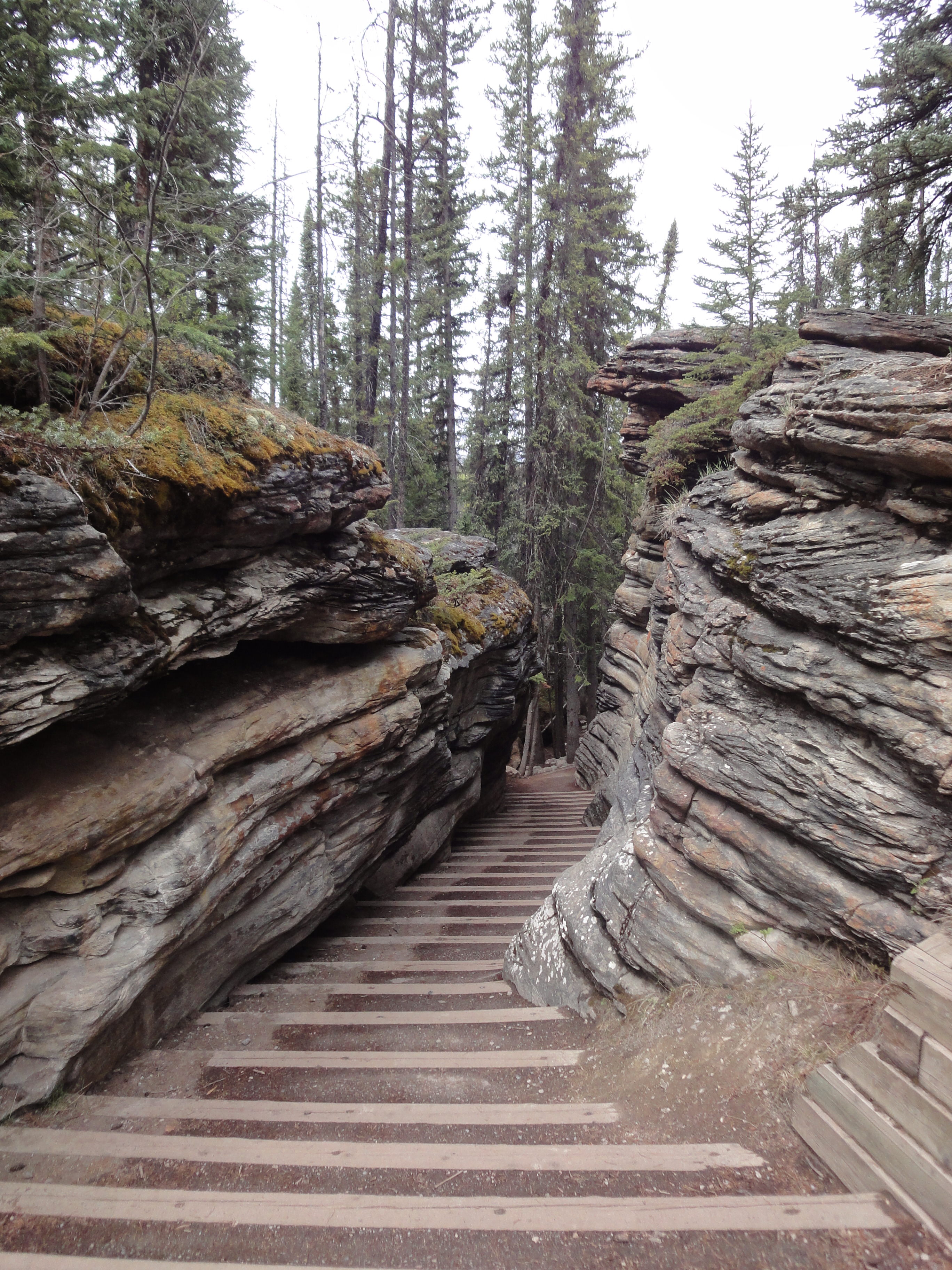
 
Athabasca boardwalkIt is very accessible, has a parking lot, boardwalks, and restroom facilities – not really “roughing it”, which works out well for most people. And for those who want more of a challenge ~ well, it’s still worth the stop on your way to wherever it is you are going!
 
And, Athabasca Falls’ headwater is the Columbia Glacier, which is part of the Columbia Icefields, about 70 kms further south.

Athabasca Falls 2
Conveniently located right on the side of the Icefields Parkway, is the Columbia Icefields Discovery Center and the Athabasca Glacier.
 
You can walk TO the Athabasca Glacier from the convenient parking lot, but you are not allowed to walk ON it, since it’s steadily receding. Apparently, it recedes at a rate of about 5 meters (16 feet) per year. If you hurry, you can still visit this one, though – it’s still 6 kms long and 1 km wide…. when you walk towards it, however, there are signs and markers along the way of how far the Glacier extended at which year… it enforces how important it is to obey the “don’t walk on this” rule.
 
Athabasca GlacierThe Explorers
You CAN take a guided bus ride on to it, by way of a “Massive Brewster Ice Explorer” (a great big bus specifically for driving up the glacier), for which you can sign up at the Visitor’s Center. They operate from mid-April to mid-October.
 
The Icefield extends from Mount Columbia (3747 meters/12,294 feet tall) on the west side to Mount Athabasca (3491 meters/11,452 feet) on the east side. It covers approximately 215 square kms (although I’ve seen a couple of reports that say 325 square kms?), and can be up to 360 meters deep… Interestingly, up to 7 meters of snow falls during the winter each year, which is more than can melt during the summer, so it continues to add mass.
GlaciersSONY DSC
There are 8 major glaciers, including the Athabasca (of course), the Dome and the Stutfield (both also can be seen from the Icefields Parkway), and the Castleguard, Columbia, and Saskatchewan.
Columbia Icefield area
 
The Icefield caps the Continental Divide and the water splits into three at Snow Dome (3,456 meters/3,456 m (11,339 ft) tall), and pours into the Arctic, the North Atlantic and the Pacific Oceans. In fact, the headwaters of the North Saskatchewan River are here, as well as the Columbia Basin.
 
Next stop: Banff National Park.

http://www.icefieldsparkway.ca/journey.html

http://www.explorerockies.com/columbia-icefield/

http://en.wikipedia.org/wiki/Columbia_Icefield

Wednesday, October 3, 2012

The World's Largest Buffalo

I just looked down for maybe a minute (doing a puzzle - Hidato), and almost missed -

DOG RIVER, Saskatchewan!

I didn't know it was there! 

If you don't know Dog River, you must not have seen "Corner Gas" (http://www.cornergas.com/), which is a funny, happy, quirky Canadian sit-com...try to find it on re-runs!

(The real town is Rouleau, SK, but the sign on the grain silo is "Dog River".  Google map http://goo.gl/maps/80yct)

OK - on to the Tallest Stalks of Wheat! 

I'm not totally sure these are the record holding Tallest Stalks of Wheat, but, even if they aren’t, they are really pretty, and make driving through Weyburn, SK that much nicer. (Google map http://goo.gl/maps/k4vq7).
 It's amazing what qualifies for a roadside attraction! What I love is that some of the "attractions" are so crazy, you have to really admire the person who said, "Let’s build the World’s Largest Mosquito so people will stop in our little town." And it works. ("Mossy the Mosquito" is in Rainbow Lake, Alberta. I don’t know where that is, but if I’m ever there, I will be sure to stop.)
I’m browsing the roadsideattraction.ca site and am finding out that, in Calgary, I should be able to see: King Kong climbing a building, a giant rooster, tulips and beetle, and an upside down church... I haven't seen these things... I might need to go on a local field trip...

Which is totally off the subject- we’re on a roadtrip!

We didn’t go through Weyburn to see the Wheat - we went there because it’s enroute to Fargo ND...Yeah, that’s right! You heard me - Fargo ND.

Jamestown ND is also enroute, and home to the World’s Largest Buffalo.

There isn’t a sign (or if there is, we missed it) for "World’s Largest Buffalo", so we took a guess that it was at the National Buffalo Museum. (It’s actually just passed there at the Frontier Village http://goo.gl/maps/j1ZdB).

First of all, the Village is a cute little old-west street, with stores and buildings rescued from various places around North Dakota. There, you can take a stagecoach ride (we didn’t - we usually travel with two little dogs, Daisy & Coco, who don’t love horses), visit the little house dedicated to the works of Louis L’Amour (who is apparently from Jamestown), and go for a drink at the local saloon.
We didn’t do any of that - I just wanted to see the World’s Largest Buffalo. And it was HUGE!! Gigantic! Totally worth it! I thought it’d be a plastic looking thing, but it looks just like a giant buffalo! (That's Peter, Daisy & Coco standing in the buffalo's shade.)
From there, you can see a couple albino buffalo, too. (In fact, that’s how I convinced Peter to go visit.) They were far away, and at first I thought one was a white rock, but THEN! It got up and started walking. My pictures aren’t great (I didn’t have "the big camera" with me at the time), and by "not great", I mean "terrible", but here they are anyway. (You can Google for better picture OR, even better, go there and take your own!

Next time, I’ll bring the big camera.

There was more to do, more to see - we could’ve stayed longer, but we had to get to Fargo... to be continued Sunday.

(In other news - I can't figure out how to put a "follow" button on here, so if anyone could tell me that, that'd be great! Also, I can't figure out how to allow people who aren't members of "blogspot" to comment, either... I'm certain it's an easy fix, but I don't know what it is... In the meantime, and because of that, I'm also blogging on http://biggestballofstring.wordpress.com, which has a "follow" button right there and anyone can comment...)

Tuesday, September 25, 2012

Outlook, SK (or as Peter calls it "Look Out!")

I don’t know how many of you have ever been to Saskatchewan (again - Sas-KATCH-ewan, not Saska-CHEW-an), but Peter told me years ago that we would never, ever go. Not even to cross it off "the list".

This is because his grandparents were from there, and they had had to drive that long, straight, road, back and forth, back and forth, to visit. And, while I’m completely entertained by long straight stretches with nothing in them but grass and the occasional cloud, it’s probably much more boring to 3 little boys, trapped in the car.

But then! Friends moved there - and not to the thriving metropolis of Saskatoon, but to a little town an hour or so south, called Outlook (Google map http://goo.gl/maps/DtyrQ). So, despite the "never, ever going", we’ve been there now - let me see - this time was our third time! (once to Saskatoon, and twice, so far, to Outlook.)
  

Outlook is a comfortable, friendly little town, where they keep a list beside the till at the local grocery store so you can sign up to attend the latest wedding shower, of the latest someone that everyone knows!

Instead of car dealerships, mainstreet is packed with farm equipment dealerships, and it’s not unusual to share the road with (or more accurately - to be run off the road by) massive combiner or the machines that haul the irrigation sprinklers...
It’s ok, though, to be run off the road in Saskatchewan. Except for the rolling hills, here and there, it’s completely and totally flat. (Apparently, the highest point in Saskatchewan is 1467 feet and the lowest is 699 feet...)
 
THIS is a picture of (or was it from?) one of the highest points in Saskatchewan.
Really! I’m not kidding!


 There’s lots to see and do in Outlook and we actually ran out of time, but one of the things is walking the Skytrail Bridge. It's an old railway bridge, converted to a pedestrian bridge, that goes over the South Saskatchewan River, and is over ½ mile long.

The River is a beautiful, lazy (at least at this point) river, and the weirdest thing about it is that it’s running North - my brain really wanted it to be running South and had a hard time wrapping itself around the northern flow.

It turns out that
"Saskatchewan"
is taken from a Cree word for
"Swift Flowing River".
I don’t get it - I guess there’s probably rapids somewhere...? (Probably someone who’s been there more than 3 times,
or someone who lives there, could answer that...?)


Below the bridge is a nice, full hook-up campground with a public pool, at the Outlook & District Regional Park (just in case you decide to visit and don’t know anyone).
http://www.outlookregpark.ca/campground1.html

And, if all of that doesn’t entice you, THERE ARE FIREFLIES!!!
(See you Sunday - we'll be enroute to North Dakota.)