Showing posts with label Dawson Creek. Show all posts

Sunday, June 9, 2013

Dawson Creek, Mile 0 of the Alaska Highway

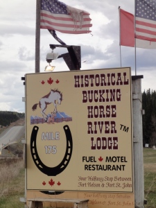
Buckinghorse River LodgeIt is 450 kms from Fort Nelson to Dawson Creek, the beginning of the Alaska Highway.
 
That 450 kms is jammed packed with … ummmm…. trees… mountains… and animals… and Buckinghorse River Lodge.
 
The Historical Buckinghorse River Lodge is at Milepost 175, and it seems that it’s “claim to fame” is that its half way between Fort Nelson and Fort St. John. It is 30 miles north of Pink Mountain. Pink Mountain DOES sound interesting! From a distance, it looks pink because of all the fireweed blossoms! (So, I suppose, you have to be there in the late summer to see that.)
Toad River
Not quite enroute, is Toad River. (I should’ve brought it up on the last blog, but I wanted to talk about Loaded Joe’s from Dixie Lee’s instead! Toad River is actually 188 kms before Fort Nelson and 60 kms after Muncho Lake.) The Toad River Lodge‘s claim-to-fame is it’s World Famous hat collection, consisting of over 7,000 hats nailed to the ceiling. The Lodge has motel rooms, cabins, RV parking, laundry, and auto mechanic (really good idea, since you are way out there in the middle of nowhere!!) and a full service restaurant.
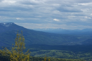
Alaska Highway Scenery, tooAlaska Highway Scenery
"Go that-a-way"
Enroute, however, IS Fort St. John (Milepost 47), which happens to be British Columbia’s oldest non-native interior community, originally established in 1794, as a trading post. The majority of settlers didn’t arrive, though, until the 1930′s, when people from the Prairie areas were trying to find new opportunities during The Dirty 30′s (Canada’s Great Depression.)

We stayed over night at Fort St. John, and it was a typical town – I’m sure there’s tons to do there, but we were just passing through.
 
Dawson CreekPassing through, on our way to Dawson Creek. The actual Creek was named for the leader of a surveyor team (George M. Dawson) who came through in 1879. By 1919, there were a few hotels and stores, and (thanks to the Railway coming through in 1931) around 500 people lived there by 1941. However, the main influx of people came after the completion of the Alaska Highway, and as of the 2011 Census, the population was around 12,000.
 

Mile 0


You can visit the South Peace Historical Society Railway Station Museum at the original Northern Alberta Railway Station.


Dawson’s Claim-to-Fame is, as mentioned, that it is the start of the Alaska Highway, the Mile 0… On the “Biggest Ball of String” theme, this is a big deal and totally worth stopping for a picture.


Our animal sightings for the day include: Black bear, caribou, dall sheep, deer, elk and moose.
 
Next, we are on our way to Prince George, B.C.
 

Wednesday, May 29, 2013

The Alaska Highway

 
Born to be wild
“Get your motor running,
head out on the highway,
Looking for adventure
in whatever comes our way.”
 
I don’t think they were singing about “the Alaska Highway”… but they should’ve been.
 
Our goal was Muncho Lake. To get there, we were taking the Alaska Highway and we were excited! The Alaska Highway runs from Dawson Creek, BC to Delta Junction, AK, and passes through Whitehorse, YT. (Whitehorse, our starting point, is about 2/3 of the way from Mile 0, at Dawson Creek.)
 
Alaska HighwayThe Alaska Highway was completed in 1942, and was approximately 2700km (1700 miles) long, but is now 2232 kms (1387 miles) long, thanks to some rerouting and straightening of the highway, over the years. It’s original purpose was to connect Alaska to the “Lower 48″, but it didn’t make it through BC (although, some people consider it to be a portion of the Pan-American Highway, which goes all the way to Argentina.)
 
What shocked me the most is that this super famous highway has MILES of gravel. Google sites say that it’s paved over its entire length, and maybe that was true at some point, and maybe it’s in a state of pre-repair, but (at least when we were driving it) there are, in fact, miles of gravel road.
 
Continental Divide LodgeOur first stop, not including bathroom breaks, was the Continental Divide Lodge, in Swift River, Yukon. It’s on Historic Mile 721 on the Alaska Highway. (By the way, http://www.milepost.com/highway_info/alaska_highway gives an almost mile by mile outline of what you might see along the way, and where there are places to stop… this is important, way out there on the open highway – where you might actually see no civilization for days…)
 
We didn’t stay there (we were just stopping for a bathroom break, and for everyone to just get out of the car…and to reload our snack supplies.) However, the Lodge is open 7 days a week, 7am-8pm, May to September (weather and roads permitting.)
 
watershedThe Lodge offers a restaurant, a pub, a campground, free showers (if you are camping, which also have full-hookups) and $5 showers if you aren’t staying there, but really need a shower (again – long gaps between civilization), playgrounds, marshmallow roasts, dog walking, and laundry facilities.
 
It is actually AT the Continental Divide - the watersheds are the Yukon River (which eventually empties into the Pacific Ocean) and the Mackenzie River (which eventually empties into the Arctic Ocean.)

Sometime before we arrived at the Continental Divide Lodge (in the Yukon), we passed over the border into B.C… then back into Yukon…where we stayed until we reached Watson Lake, YT (Historic Mile Post 635).
 
Sign Post ForestWatson Lake is the “Gateway to the Yukon”, and has a population of around 1200. It is the home of the Northern Lights Space and Science Centre. Did you know that both Northern and Southern hemispheres both have the Northern Lights (Aurora Borealis)? Well, except…ummm….in the Southern hemisphere, they are called the Southern Lights (Aurora Australis)…
 
Sign Post Forest

 
Watson Lake is also home to the just-as-spectacular (?) Sign Post Forest. Started in 1942, a homesick U.S. Army G.I. nailed up a sign, pointing the way home. In 1990, the 10,000th sign went up, and the last number I could find is 2002 at 49,777, and include signs from all over the world.
 
On Sunday, we’ll continue our journey from Watson Lake, on to Muncho Lake.