Wednesday, May 29, 2013

The Alaska Highway

 
Born to be wild
“Get your motor running,
head out on the highway,
Looking for adventure
in whatever comes our way.”
 
I don’t think they were singing about “the Alaska Highway”… but they should’ve been.
 
Our goal was Muncho Lake. To get there, we were taking the Alaska Highway and we were excited! The Alaska Highway runs from Dawson Creek, BC to Delta Junction, AK, and passes through Whitehorse, YT. (Whitehorse, our starting point, is about 2/3 of the way from Mile 0, at Dawson Creek.)
 
Alaska HighwayThe Alaska Highway was completed in 1942, and was approximately 2700km (1700 miles) long, but is now 2232 kms (1387 miles) long, thanks to some rerouting and straightening of the highway, over the years. It’s original purpose was to connect Alaska to the “Lower 48″, but it didn’t make it through BC (although, some people consider it to be a portion of the Pan-American Highway, which goes all the way to Argentina.)
 
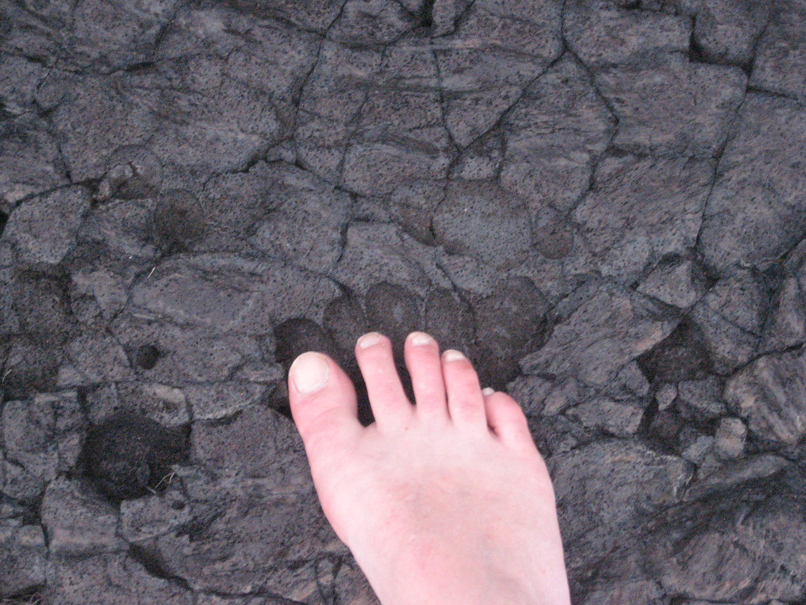
What shocked me the most is that this super famous highway has MILES of gravel. Google sites say that it’s paved over its entire length, and maybe that was true at some point, and maybe it’s in a state of pre-repair, but (at least when we were driving it) there are, in fact, miles of gravel road.
 
Continental Divide LodgeOur first stop, not including bathroom breaks, was the Continental Divide Lodge, in Swift River, Yukon. It’s on Historic Mile 721 on the Alaska Highway. (By the way, http://www.milepost.com/highway_info/alaska_highway gives an almost mile by mile outline of what you might see along the way, and where there are places to stop… this is important, way out there on the open highway – where you might actually see no civilization for days…)
 
We didn’t stay there (we were just stopping for a bathroom break, and for everyone to just get out of the car…and to reload our snack supplies.) However, the Lodge is open 7 days a week, 7am-8pm, May to September (weather and roads permitting.)
 
watershedThe Lodge offers a restaurant, a pub, a campground, free showers (if you are camping, which also have full-hookups) and $5 showers if you aren’t staying there, but really need a shower (again – long gaps between civilization), playgrounds, marshmallow roasts, dog walking, and laundry facilities.
 
It is actually AT the Continental Divide - the watersheds are the Yukon River (which eventually empties into the Pacific Ocean) and the Mackenzie River (which eventually empties into the Arctic Ocean.)

Sometime before we arrived at the Continental Divide Lodge (in the Yukon), we passed over the border into B.C… then back into Yukon…where we stayed until we reached Watson Lake, YT (Historic Mile Post 635).
 
Sign Post ForestWatson Lake is the “Gateway to the Yukon”, and has a population of around 1200. It is the home of the Northern Lights Space and Science Centre. Did you know that both Northern and Southern hemispheres both have the Northern Lights (Aurora Borealis)? Well, except…ummm….in the Southern hemisphere, they are called the Southern Lights (Aurora Australis)…
 
Sign Post Forest

 
Watson Lake is also home to the just-as-spectacular (?) Sign Post Forest. Started in 1942, a homesick U.S. Army G.I. nailed up a sign, pointing the way home. In 1990, the 10,000th sign went up, and the last number I could find is 2002 at 49,777, and include signs from all over the world.
 
On Sunday, we’ll continue our journey from Watson Lake, on to Muncho Lake.
 

Sunday, May 26, 2013

"Yukon Ho!"

Somewhere over the YukonI planned to talk more about Hawaii, and the Green Sand Beach in particular, but I have a bit of a complication (short-lived, hopefully), with my Hawaii photos…

So, since our great & wonderful friends, Richard and Shannan, (perhaps you’ve read about them already in my stories…) happen to be visiting us this weekend, I’ve decided to tell a story about their move from Alaska to Michigan…

You may have read my blog about going to visit them in Alaska, after they moved there from Michigan, and this blog is about their “turn-around” trip – 3 years later.
Shannan and I were discussing their upcoming move, and she was talking about how long it was, and how it’d be more fun if it was a “roadtrip” instead of a move. Also, they had two cars, they’d be driving the entire way in different vehicles.   I said “too bad we couldn’t all go on the roadtrip together – besides, we haven’t been to Yukon before” (and you know, we are trying to go to all of the states and provinces).  Suddenly, at the same moment, we had the same idea! Why wouldn’t we go!?  We were excited for this very spontaneous adventure!

Daisy & Coco in the airportSo, we planned to fly up to Whitehorse YT and they’d pick us up at the airport!  Just to put things into a location, Whitehorse is 272 km (169 miles) almost directly north of Juneau AK and 804 km (499 miles) almost directly east of Anchorage.  (However, you can’t drive directly east/west – Google maps says it’s 704 miles (1133 kms), by road.)

Daisy & Coco on the planeDaisy & Coco (our miniature dachshunds – perhaps you’ve read about them in previous blogs, too) came with us, too – after all, it’s a roadtrip!  This was the first (and probably the last) time they had flown… they hated it.  I’d talked to the vet and a pilot friend of mine and everyone said “don’t sedate them” but that they could have an herbal de-stresser.  (Apparently, sedating can cause panic if the dog doesn’t handle it well..?) I did give them the herbal remedy, and I’m sure it helped, but they stared at us from their little carriages the entire 3 hours! (They are small enough to fly with us in the cabin, rather than in the belly of the plane.)
I expected the land of the Yukon Territory to be similar to that of Alaska, as our view from the airplane, but it wasn’t at all! For one thing – it was “flat” (at least, compared to Alaska) -almost like rolling hills. Very beautiful landscape.  However, not exactly flat – just the part we flew over.

Wikipedia states that “the southwest is dominated by the Kluane icefields in Kluane National Park and Reserve, the largest non-polar icefields in the world. Kluane National Park also contains eight of Canada’s ten highest mountains, including the five highest, all in the Saint Elias Mountains. A number of glaciers flow out of the icefields, including the Logan Glacier, the Hubbard Glacier and the Kaskawulsh Glacier.” 

The Yukon Territory was first established in 1896, when it was divided out from NorthWest Territory, but had a population explosion in 1897, with the Klondike Gold Rush. (And, by the way, I just read:  the Yukon Territory became just Yukon, in 2002.  Oops! I did not know that.)

KlondikeThe original gold find prompted an estimated 100,000 prospectors to try their hand at looking for gold, but apparently, only 30,000-40,000 of them actually managed to arrive! (Not sure why – I’m sure the information is there, I just didn’t look for it – I’m guessing terrible travelling conditions, cold weather, rival prospectors and local people prevented most.)  Of those who managed to make it, only about 4,000 actually found gold.

During that time, Robert Service moved in from England. He wasn’t looking for gold – he wanted to be a cattle rancher.  He loved the North and he embraced the winter, but he didn’t make his success through cattle ranching.  He did it through his poetry.

Perhaps you’ve heard of “The Cremation of Sam McGee.” 
“There are strange things done in the midnight sun
      By the men who moil for gold;
The Arctic trails have their secret tales
      That would make your blood run cold;”  (etc.)
 
Rumor has it that, in real life, Sam McGee was a banker who wouldn’t approve Mr. Service’s loan, so Sam became the subject of the infamous poem (and one of my favorites).

 We landed safely in Whitehorse, and the puppies were so happy to get off the plane and out of their crates, they didn’t even care that they were getting straight into a car with 2 kids and another dog! Peter and Richard went in one car (the one pulling the cargo trailer) with the baby, and Shannan and I took their other son, and all the dogs.

Richard and Shannan had rented a nice little place that Shannan found online about 5 miles outside of Whitehorse.  A 2 bedroom, full kitchen, full bathroom, large (enough) living room and a gigantic yard, perfectly suited for children and dogs and adults who’ve been cooped up!

The property includes an outdoor hot tub, and indoor sauna, walking trails, mountain views, and allow dogs! Very comfortable.  We could have stayed longer.  But we just stayed the one night and the next day, hit the road!

Alaska Highway, Wednesday.

Wednesday, May 22, 2013

Pahoa’s Mexican Food, Li Hing Mui, and the Chicken Guy

Old PahoaGoing and coming to Kalapana, you must pass through (or right beside, depending on the exact road) Pahoa.
When I was telling Amanda about Pahoa, I mentioned: 1) the best Mexican food on the island (Luquin’s), 2) the first time we were there, there was a brawl in the street of Old Pahoa, like “old West” style, with, it turns out, fireworks going off, but it sounded like gun-shots, and 3) there’s a guy who rides around on his bicycle, with a chicken on his shoulder.
There’s a lot more to Pahoa than that, but those are my highlights.
Luquin’s ~ If you have read my blog off and on from the beginning, you will know that Mexican food is an ongoing theme – a constant under-current. I love Mexican food. I mean ~ I’m not adventurous at all. I order the same exact thing wherever I go: a cheese enchilada, a beef enchilada, and soft shell (if available) beef taco. I do switch it up with the sauce ~ choosing randomly (so as to throw chaos into the situation) between tomato, mole and verde sauces.
Lilikoi Mango Margarita, with li hing muiPeter switches things around, but always gets chili relleno (at every Mexican restaurant).
And, always, a margarita – house specialty, blended, if possible. At Luquins, my favorite FAVORITE is lilikoi (passion fruit) mango combo, blended, with a Li hing mui rim. Wikipedia says “Many bars in Hawaii also rim their glasses with li hing powder in addition to putting it in the drink.” I wonder why it’s specific to Hawaii… SERIOUSLY! if you try it, you will LOVE IT! Love love love it.
Luquin’s always is exactly what we hope for! We are never disappointed.
We’ve also been to 2 other really good restaurants right on the main street in Old Pahoa, across the street from Luquins – one is Thai food, and the other is a fancier style restaurant – I forget the names of both places. However, we were told that the Thai restaurant rivals the Thai food in Volcano Village, and the cost is less expensive. We’ve eaten there, and I remember it being good – I think that’s the place that has Trivia Pursuit cards at each table, in case dinner conversation wanes. (You should still go to the one in Volcano Village, too, though.)
Enchilada Chili Relleno
Somewhere in Pahoa is the Black Rock Cafe, which is half bar (not even a pub, but more saloon-y), and half restaurant. On the restaurant side (and maybe also the bar-side…?) has really good fish and chips, and I’ve never been disappointed with any of their food either.
Farmer's MarketThere’s a pretty good grocery store just as you come into town (the Kea’au way), called Malama Market. Perhaps it’s more expensive than shopping in Hilo, but it’s pretty convenient and has every possible thing you can think of! (Well, I’m not sure what all you can think of, but so far, I’ve found everything I’ve needed.)
Halfway between Pahoa and Kea’au you will find the Maku’u Farmer’s Market. It’s one the largest Farmer’s Markets on the Island, but it’s only open on Sundays, and only from 8am to 2pm… And, to get the best of the choices, you have to get there early. (Also, if you want a hotdog with “all the fixings”, you have to get there early, too. I had mine on pink Punalu’u bread (more on Punalu’u bread later, probably.)
Farmers Market purchaseKea’au also has a Farmer’s Market – it’s very small, but is open every day, for your convenient fresh vegetable and fruit shopping. I bought avocados, a bag full of rambutan (which I bought because I’d never seen such a thing and the vendor gave me an entire bag for $1), and a bunch of apple bananas for about $5.
Across the street from the Farmer’s Market is the Kea’au Shopping Center, which has everything in just 2 parking lots:
    Tom, the Chicken Guy
  • There’s a nice little grocery store there – Foodland. The prices are pretty good, and if you have a Maika’i card, you can often save about 1/4-1/3 the cost on most items.
  • There’s also a health food store there, called Kea’au Natural Foods, which has a lot of everything packed into a very small space.
  • Pizza Hut and McDonalds
  • A couple of restaurants
  • a laundromat
  • Ace Hardware (Peter’s favorite place in Kea’au)
Kea’au is on the main road going from Hilo to Volcano, and is at the turn-off to go to Pahoa. It’s a larger town than Pahoa and has more options for shopping, etc., but isn’t near as quirky.
The first time we were in Pahoa, this man rode by on his bicycle with a chicken on his shoulder. This time, I told everyone to “keep their eye out” for the “chicken guy”, but really didn’t expect to see him. The next thing you know, in the parking lot of Malama Market, there goes the chicken guy! The chicken was riding on the back of the bike this time.
Originally, apparently, Tom (the Chicken Guy) was on his way to a parade of some sort, and the chicken jumped on the back of his bike all by itself, and so started the tradition. Since then, Tom has been around here and there with his chicken (including, apparently, the Burning Man festival/event in Nevada….) He even now collects pictures that people take of him…
Sunday, I think we’ll talk about Punalu’u, South Point and the Green Sand Beach.

Sunday, May 19, 2013

Restoring the Coconut Grove ~ Kalapana and Kaimu

The first time we went to Kalapana, we were lost... I can't remember where we were trying to go, but we were not only lost, but... let's not call it "fighting"... but the attitude in the car was ... "tense"....maybe it was just me...

There were 5 of us, and I, for one, was feeling "crowded". (Oh, this was with Richard & Shannan, and their son, Evan - previously mentioned often in my stories.)

PahoehoeThen, we got to the end of the road - literally, the end of the road. In 1990, the Kilauea eruption that started in 1984 reached the village of Kalapana in 1990. The residents tried to resist the lava, putting up sandbags and whatever else could be done to preserve their houses, but in the end... the lava won. It was slow moving lava (pahoehoe*) and everyone was safe - no lives lost, which is a huge relief!! but the financial loss was huge.
Awa BarAt the end of the road (technically, at Kaimu), there was a cafe/diner place with milkshakes and burgers, an honor-system honey kiosk (jars of honey, a list of prices, and a jar to put your money in...no humans), and a bar, called "Uncle's Awa Bar."

It looked like a tiki bar from any Caribbean movie you've ever seen, so we went over and ordered a drink. "A beer, please." "Oh, we don't serve alcohol. Just awa." "What's awa?" (Pronounced, by the way, "ah-vah".)

Well! THAT is a good question! This shrub like plant is a member of the "pepper" family, and it's roots (which can be eaten or drank in tea) are used for medicine and general relaxation. Medicinally, it has been used to treat fevers, headaches, asthma and other respiratory issues...and can be used as a sedative or a muscle relaxant.
Planting Coconuts

We didn't get that explanation at all - just: "It's a drink that the ancient Hawaiians used to drink. You should have some."

Our coconut trees, 2 yrs laterSo, we did. It tasted like sweet dirt. It was nasty! BUT, within seconds, my tongue started feeling like I'd had Novocaine, and all the tenseness from being trapped in the car was forgotten! Before we knew it, Uncle had sent us out, singing in the rain (did I mention it was raining?) to the shoreline with sprouted coconuts, to help "replant Kalapana."

The picture of us sitting with our Coconut Trees is two years later. I'm happy to report that they were still there.. I mean, they weren't giant, but considering we planted them in shallow black sand, "protected" by a lava flow, where their main source of moisture is salt water sprayed from the ocean...
This time, we tried to find them again... it was difficult! The "forest" is tall!! (Many people have written on their coconuts so they can find them, but I always forget to bring a pen...or crayon...)
I think this could be them, but like I said - It's "overgrown" and I can't be certain. I am claiming them, though.


 Kalapana is now buried under 50-75 feet (16-25 meters) of lava, about 500 acres of new land have been added, and there's a brand new coastline...... and a beautiful black sand beach - it's not a good place to swim, but it's a beautiful view and you can play in the sand (unless the tide is coming in...)


You can actually hike in to see the Pu'u O'o Vent and possible hot lava sightings from the Kalapana angle. Once you are there, ask someone. We haven't done that hike yet. Reviews say it takes 20 minutes to 2 hours to get to the lava... If, in fact, you were guaranteed to see lava, that maybe not too long!!
Reviews also say that there are hustlers who offer to lead you on a tour ... Some say that they are worth it... maybe they are! We hired someone with a broken down truck to take us to the Green Sand Beach and THAT was worth it! (Topic of a later blog). I guess it's "Caveat Emptor"... "Buyer Beware." If I ever find out who's who, I'll let you know. 

(By the way - I'm not suggesting you shouldn't do the hike, nor am I suggesting that you shouldn't hire a guide.... I'm just saying I haven't done it yet, so I don't have a realistic suggestion... However, it is on my to-do list...maybe...) (The Ranger at the Jaggar Museum Lookout said to beware that trespassing may be involved...)


Without hiking, and just from the "End of the Road", you can see the Pu'u O'o Vent, and the steam from the lava river flowing down the mountain. That's pretty "worth it" anyway!
Uncle Robert's Awa Bar is now open on Wednesdays and Fridays, with live music featuring local artists! And, the ice cream shop, the Kalapana Village Cafe, has THE BEST macadamia nut chocolate Kona coffee Ice Cream!! (They might not have that exact flavor - I had so many scoops, they all melded together...and included all my favorites.)
See you Wednesday!
...
The Hawaiian Volcano Observatory's website explains "In an eruption with a high effusion rate - where a lot of lava is being
discharged at once - `a`a flows tend to form. If the rate of effusion is low, a pahoehoe flow is more likely to develop..." So, I had to look up "effusion", and in case you don't know already, "Effusion" is "the process in which individual molecules flow through a hole without collisions between molecules. This occurs if the diameter of the hole is considerably smaller than the mean free path of the molecules." Yes. That makes sense and explains the difference.
Pahoehoe
Here's what I know: "Pahoehoe lava" is smooth, and looks like thick frosting. It isn't great to walk on barefoot, but probably won't cause your feet to bleed. "A'a lava" is jagged, and hurts terrible to step on barefoot! You can remember which is which because when you step on A'a Lava, you will actually yell "Aaaaaaa! Aaaaaa!"

Wikipedia has some pretty good pictures, actually, with a good explanation. (Due to time issues, I can't find my own picture of a'a lava, but will maybe add one later.)
...
http://hvo.wr.usgs.gov/volcanowatch/archive/1999/99_05_27.html
http://www.to-hawaii.com/big-island/cities/kalapana.php
http://hvo.wr.usgs.gov/kilauea/history/1990Kalapana/http://en.wikipedia.org/wiki/Kalapana,_Hawaii
www.tcroke.com/2012/03/hiking-to-the-puuoo-lava-flow-part-1
http://www.hawaiihighways.com/photos-Red-Road.htm
www.nps.gov/havo

Wednesday, May 15, 2013

Lava Trees, Red Road and a Bengal Tiger

Peacock DadAs I mentioned in my Introduction to The Big Island blog, we were travelling with friends (Chris and Amanda, and Taylor and Jaycee (the kids)), and had lots to see and do!
One of the great things about travelling with children is that you get to do things you might not normally do, but have always wanted to do (like: camp at Jellystone Park… or visit the Jelly Belly Factory… or the Jolly Green Giant… or the zoo.)
I have passed the sign for the Pana’ewa Zoo, just outside of Hilo, a bzillion times, and every single time, I consider going, but never have. YAY!! for 7 and 9 year olds who support that notion!
Peacock mom and babies
We didn’t really expect much because it’s small, not advertised and free. (Yes! It’s FREE!! But, it’s funded by donations, so do keep that in mind.) Expecting “not much”, I took about 20 pictures of the peacock family that met us at the gate – a mommy and 4 or 5 babies meandering around.
However! We were there for hours! The zoo residents include different monkeys (a couple I’ve never even seen in books), different turtles, macaws, nenes and other birds, reptiles, anteaters (which I can’t remember actually seeing before), some sort of deer (Axis), AND A BENGAL TIGER!!! (Before you get all excited, we didn’t actually SEE the Bengal Tiger, but we were there in the morning, and his daily feeding time is 3:30, so maybe plan your visit around then…? We meant to go back later, but ran out of time.)
Crowned CraneAxis DeerGiant Anteater
Lava Tree
(NOT seeing the Bengal Tiger, though, created HOURS of entertainment as Taylor and Jaycee speculated on its whereabouts. Part of the speculation inspired the production of a off-Broadway show, in the pool*, of them trying to escape the approach of the on-the-loose Tiger…also, an on-the-loose elephant and an on-the-loose monkey.)
Another great thing is seeing things from kids’ viewpoint. Like: how the Lava Trees at Lava Tree State Monument go from being super interesting pieces of history to monster-creatures that have bugs living inside of them…and how, when you see the pictures they took of the “creatures”, there’s more pictures of them running away from them, than there are of the actual lava tree!
These Lava Trees were formed in 1790, when Kilauea’s East Rift sent lava, burying Ohi’a** Trees. The trees (which are filled with water) cooled the lava, but not before the lava burned the trees – they disintegrated into ash, but left behind hollowed-out lava molds, which often include imprints of the bark.
They are giant forms – apparently, the lava buried the Ohi’a Trees up to 11 feet!
Coqui FrogIncidentally, this area is one of the best areas for listening to Coqui Frogs. Coqui Frogs are tiny little tree frogs, originally from Puerto Rico (where they are revered) and accidentally brought to Hawaii (where they are hated.) However, I love them. Actually love them! I’m not sure what they are hated, but I guess it’s because they aren’t native to Hawaii and that they are loud (really loud – they can reach up to 70-90 decibels, singing out their namesake song “Ko KEE! Ko Kee“).
Peter and Jaycee and Taylor spent a few evenings out in the yard “hunting” coqui frogs – for photo opps, only, of course. They are pretty cute little things. (By the way, this picture shows how small the coquis are – I don’t have a giant hand!)
If you continue down Hwy 132 (Kapoho Road), and then onto Hwy 137 (Kapoho Kalapana Road), you are (as you might guess from the name) on your way to Kalapana, which is where we wanted to go next.
Kapoho Kalapana Road is also known as “Red Road”. Once upon a time (not that long ago), it was red because the pavement was made from red cinder. However, as time as gone by and road repairs have been required, it’s now completely black. If there’s any red left, we missed it. The first time we went on this road was … I forget – maybe 10 years ago? and at that time, it was still partially red.
Red Road will lead you passed quite a few sites at which to stop, including:

  • Hot PondsAhalanui Park (the Hot Ponds) - a free, natural pond, - ”natural” in that it’s fed by rain water & ocean water, and heated geothermically. It does have man-made walls, stairs going in, and life guard attendance. (One of the life guards this past time we were there was climbing the coconut trees barefoot and bringing down coconuts, which he hacked open with a machete and gave us the yummy coconut milk.)
  • Isaac Hale State Park – this is a beautiful location where surfers and paddle-boarders brave getting thrown directly into a’a lava. The first time we went was kind of uncomfortable (not very hospitable crowd), but we came back year after year anyway, and now “they’ve paved paradise and put up a parking lot.” (Joni Mitchell) I’m not sure how I feel about that, and I’m really not sure how the locals feel about that, but it’s far more tourist-friendly now.
  • Mackenzie State ParkMacKenzie State Park – another beautiful view and a nice picnic place. The really high cliffs and crashing waves make it impossible to swim… In fact, I get nervous standing too close to the edge. But the view is amazing and it’s close enough to Red Road to make the stop worthwhile!
  • Kehena Black Sand Beach - my younger brother took us on our first tour down Red Road, and stopped along the side of the road, so we could walk down to the “best black sand swimming beach on the Island”, he said. He said, “it’s got such an amazing view, you have to bring your camera.” Along a little wooded path, and down a worn lava rock sort-of-like-a-staircase, suddenly the beach appeared down below. In the meantime, people kept passing us on the way out, and kind of giving us funny looks. As we admired the waves crashing in, the rocks jutting out of the sea, I started noticing a man, way down below, scooping water in a bucket and tossing it onto the sand… as he came into focus, I realized why the people were eyeing me carrying my camera, and why my brother was now laughing hysterically – it’s a nude beach. (Well, technically, “clothing optional”.) Just so you know.
  • Finally, the end of the road (because a lava flow went over the top): Kalapana and Kaimu Beach Park.
More on Kalapana on Sunday.
….
Pool deck
* We stayed at a lovely VRBO right on Kaloli Point. It’s a 2+1 bedroom, 2 bathroom main house with a full kitchen, and patio garden doors which open up the wall to the pool deck. The pool is a salt water pool. There’s also a detached 1 bedroom, 1 bathroom (with an outdoor lava rock shower) ohana suite (“Ohana” in Hawaiian means “family”, so it’s like a mother-in-law suite).
Inside our vrbo


** Ohi’a Trees are very majestic, not very pretty, trees, and endemic to Hawaii. In fact, the red Lehua blossom is the Official Flower of the Big Island. They can grow from sea-level up to 9000 feet, in rain forest conditions or on the edge of the volcano. And, depending upon its conditions, can grow up to 20–25 m (66–82 ft) tall, and lives 100′s and 100′s of years.
Ohi'aLehua Blossom

Sunday, May 12, 2013

Volcano Village

It’s important to remember that the Volcano National Park and Volcano Village area are around 4500-5000 feet above sea-level and often COLD!!!!
Tree HouseOne time, we stayed in a cabin there (which had no heat…or walls…well, there were walls, but they didn’t quite reach the roof (the cabin was still a work in progress)…and the roof had a hole in it for the tree to grow through…loved the cabin! BUT it was COLD! It was so cold, I actually wore all the clothes I had in my suitcase, all at once, to bed. It didn’t snow, but it could have.
Cabin in Volcano
Cold


So, bring a sweater. And, a raincoat. (The first time we were there, the rain was so cold and drizzly, and I was wearing shorts and a t-shirt, and was already acclimatized to the 80°s Fahrenheit (27° Celcius) temperatures from lower altitudes, I ended up wearing a plastic grocery bag on my head to keep the cold rain off.)
That’s not to say it’s always cold. But chances are good. And, even if it’s not cold, it’s still more chilly than down by the ocean.
Sometimes the rain is a relief, anyway. If you are prepared.
About 15 minutes from the entrance to Hawaii Volcanoes National Park (going towards South Point) is the trail head for Ka’u Desert Trail. (There’s a much longer way to get there, too, through the park, but…it’s much longer…)
This Trail takes you to (and passed) foot prints, forever embedded in mud-ash. Just every day footprints. We actually saw one footprint in the back yard area in one of the vrbo’s we stayed at, down by the shoreline (we think).
FootprintFootprint 1
We haven’t been on this trail yet (I had it on my to-do list this last trip, but ran out of time… However – that link tells all about it. Don’t panic when you read the first description – keep going till you get to the easier route.
Wine Glass Choice #2
Wine Glass #1In Volcano Village is one of the best Thai restaurants on the Island – Thai Thai. People come from all over the Island just to have dinner there (and, since, as I mentioned, the Island is HUGE – this can mean drives up to 2 1/2 hours or more!) If you go to Volcano, you are just as likely to be asked if you went to Thai Thai as you are to be asked if you went to the Thurston Lava Tube. It’s delicious food, an acceptable price, and mismatched wine glasses. You never know at what point you are going to go someplace, with high expectations and have them destroyed by popularity and conformity. I will be so disappointed the day I go and my wine glass matches someone else’s. But for now – so far so good.


..
You can stay right in the National Park – the Hawaii Volcano House has motel rooms and cabins available. It’s the oldest hotel in Hawaii (state or Island? not sure), established in 1846, but has been restored, and recently renovated. It overlooks the Halema’uma’u Crater.
We’ve never stayed there, but I’m sure the view makes it all worthwhile! We always rent homes from the www.vrbo.com (Vacation Rental By Owner) website. So far, we’ve had very successful stays, with no disappointments.
So far, in the Volcano area, we’ve stayed at the aforementioned cabin (not a vrbo), a house in the nearby jungle, and a house at the Volcano Golf Course.

Mauna Kea, Ozinuka Astronomy CenterThe Golf Course is an 18-hole course (par 72)… I took golf lessons (from a golf genius here in Calgary) and so was anxious to go golfing here. I decided I’d just do 9 holes, so as not to frustrate myself, the people with me (Peter and Richard, that particular time), and the people behind me.
It was so much fun, with such beautiful views (you can see both Mauna Loa and Mauna Kea from the course), I decided to continue on for the 18! (Although, I must confess: I did really lost my concentration when the group of Nene’s* wandered through, with babies in tow… SOO CUTE!!)
Nene family
Visit, too, the Volcano Winery, for wine tasting and gift shopping. They are open 10am-5pm, every single day, except Christmas. (10am seems a tiny bit early for wine tasting, but at least you know it’s open if you forgot to buy someone’s gift!)
Wine TastingSample sizeVolcano Winery
And, Don’t forget the Volcano Farmer’s Market! But, you have to be there at the crack of dawn – I mean, truly! it’s only open from 8am to 10pm…so… we slept through it. The friends we were travelling with, though, sacrificed themselves and went – bringing home yummy samplings for us to try when we woke up!
It seems to me that they brought malasadas…which, I don’t know if that’s true, now, or just a sweet dream… Wait’ll we talk about malasadas! They are even more popular than Thai Thai!
See you Wednesday!
Don't Feed the Nene


* Nene are the Hawaiian State bird, and looks very similar to a Canada Goose. However (and I’m not sure what all the differences are), but the Nene can only be found in the state of Hawaii (and specifically on the islands of Hawaii (Big Island), Maui and Kaua’i.) I thought that they couldn’t actually fly since I’ve only seen them running and walking along the ground, but apparently they can fly…they just don’t choose to do it often. The Nene is, it turns out, the World’s Rarest Goose… in 2004, it was estimated that there were (approximately) 800 in the wild…
Nene Crossing
There are signs everywhere that caution you to “watch for Nene crossing the road” and “don’t feed the Nene”. PAY ATTENTION!