 Not quite as tall as the Hi’ilawe Falls, and not as ummm… petite… as Rainbow Falls, Akaka Falls stands out. It falls straight down 442 feet (129 meters), and you can semi-easily get to it’s Overlook. (“Easy”, in that there are pathways right to it, and “semi” in that there’s a lot of stairs, so if you need your inhaler, take it with you.)
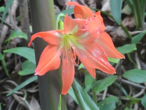
Hiking to Akaka Falls is a nice walk through bamboo forests, passed Kahuna Falls (100 feet), oversized trees and huge flowers.
 There is now a $5 parking and access fee (for non-residents) , which was a big surprise to me, but still worth going. (The parking area is about 11 miles North of Hilo, and through a cute little town, Honomu, where we stop each time to buy water (which we always forget), ice cream, and browse through antique bottles displayed at one of the shops.)
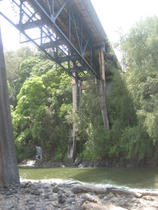
 Akaka Falls is on the Kolekole Stream, and just past the turn-off is Kolekole Beach Park. You can see the beautiful scene from the bridge that goes overhead, but it’s gorgeous inside the park, with bridges and trees covered in moss, a waterfall off to the side… it’s a bit isolated, though, in my opinion – even though you can see it from the road… and people live in the trees in tents… I mean…maybe they were just camping, but they weren’t excited that we were there… Although, one of my friends who lives on the Island says it’s safe, so it probably is… Beautiful, anyway – if you just want to take a peek….
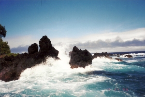
 Before you get to the turn-off to Akaka Falls, though, pay attention to the small sign on the right side of the road (coming from Hilo ) that identifies the 4 mile scenic loop. It might say “Onomea Bay Scenic Route”…I can’t remember. (Coming from Hilo is the best angle because you are on the outside lane, overlooking the cliffs and Ocean.)
Don’t assume that you can just zoom down the road in a few minutes – be prepared to pull over on the side of the road for random hikes and photo opportunities. There are roads that take you down the side of the cliff, right to the shoreline. (One such road also takes you to the back gate of the Botanical Garden. They have a gate with a gate keeper – you can’t (and shouldn’t try) to sneak in. However, you can get a nice glance at the Gardens – enough to consider paying the price to go in.)
It’s normally open 9am to 5pm, everyday, and is only $15 for adults! It’s approximately 40 acres and contains over 2000 species of tropical plants.


About 1/2 way between Hilo and Honoka’a (which is our final destination on this particular blog) is Laupahoehoe, and I have to tell you – the view is MAJESTIC!! (Especially if you are coming from the Kona-side, through Waimea.)
 On our very first trip to Hawaii, we landed on the Kona-side, which is beautiful, but more…dry…and doesn’t smell like greenhouse… and wasn’t exactly as I had imagined Hawaii to be. BUT, as we drove around to the other side (through rolling hills and fields of pear cactus) and then came around this corner and there in front of us was a view of Laupahoehoe, I actually gasped out loud because of it’s beauty!
(This same gasp triggered a …uh… reprimand… from Peter, who was driving, and thought something had jumped in the road – or some other disastrous event which might initiate a “GASP”!)
 Amazing view! Amazing! On my Top 3 on the Island! (The top 3 really are all tied for #1. I can’t really say which is the most spectacular… but, there’s Laupahoehoe, Waipio Valley, and the view of Whittington Park, near South Point, especially coming from Kona.)
Speaking of Waipio Valley, Honoka’a is the Gateway to Waipio Valley.
It’s a cute little weather beaten town, which I love. BUT it’s BIGGEST claim to fame is TEX DRIVE IN!!
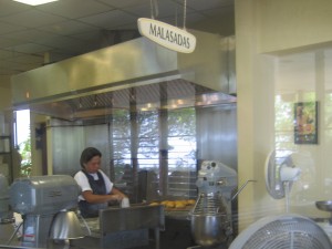
 What is so great about Tex Drive-in you wonder? OK! I am not exaggerating when I tell you that they have the world’s GREATEST Malasada! (I confess – I’ve never had them anywhere else, but I am convinced that there is no way that they could be any better than they are here!) They are so good and so appreciated in Hawaii, apparently, there is Malasada Day! (I just learned this, just now.)
 Have you tried Malasada? Wikipedia defines: “a Portuguese confection, made of egg-sized balls of yeast dough that are deep-fried in oil and coated with granulated sugar.” … Basically, they are like… a light airy doughnut, without the hole in the middle, and often filled with something yummy, like strawberry, or chocolate, or lilikoi. Mmmmmmmmm…
They make them in the morning, and you really should be there FIRST THING! They open at 6:30am. The earliest I’ve made it there was 9am, and they had already sold out of their most popular flavors.

(I found a recipe for “Tex style malasada” on epicurious.com. I’m 100% positive they won’t be as good if you try to make them, but don’t let that discourage you!! I might try, too, because I’m CRAVING THEM now!!)
Not sure what we’ll be talking about next week – I think the North Shore of Hawaii… for now, all I can think about is Malasada!
(Or, I might interrupt my Hawaii theme with a short blog about Global Fest, here in Calgary. I totally forgot I have tickets to go, so it depends – might write something for Wednesday…)


