Sunday, August 18, 2013

Hamakua Coast and Malasadas

Akaka Falls
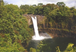
Not quite as tall as the Hi’ilawe Falls, and not as ummm… petite… as Rainbow Falls, Akaka Falls stands out. It falls straight down 442 feet (129 meters), and you can semi-easily get to it’s Overlook. (“Easy”, in that there are pathways right to it, and “semi” in that there’s a lot of stairs, so if you need your inhaler, take it with you.)
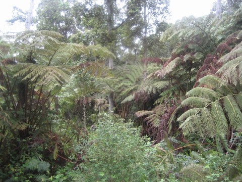
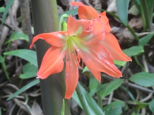
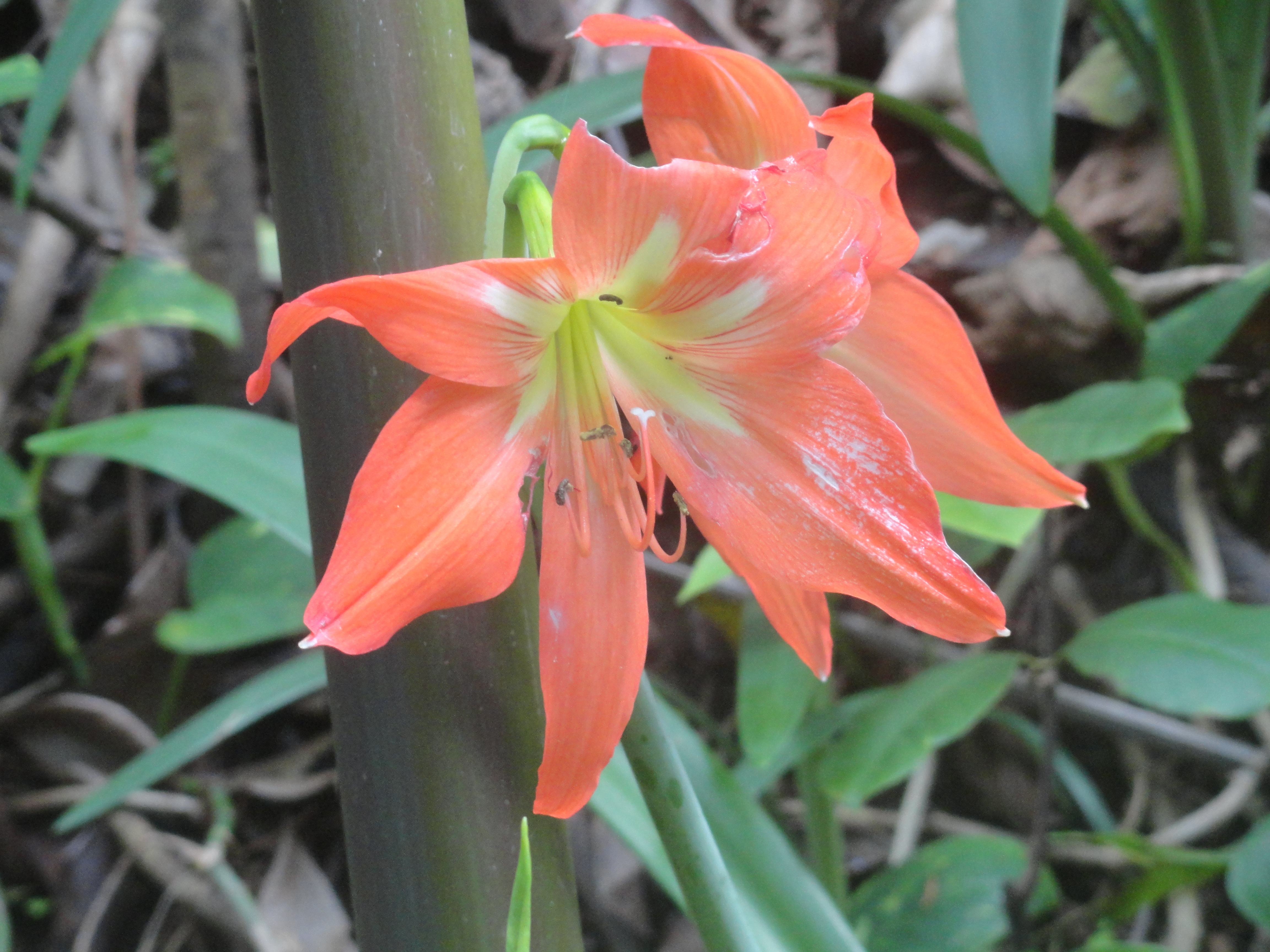
Hiking to Akaka Falls is a nice walk through bamboo forests, passed Kahuna Falls (100 feet), oversized trees and huge flowers.
Akaka WalkThere is now a $5 parking and access fee (for non-residents) , which was a big surprise to me, but still worth going. (The parking area is about 11 miles North of Hilo, and through a cute little town, Honomu, where we stop each time to buy water (which we always forget), ice cream, and browse through antique bottles displayed at one of the shops.)
KoleKole from under Hwy 11KoleKole Beach ParkAkaka Falls is on the Kolekole Stream, and just past the turn-off is Kolekole Beach Park. You can see the beautiful scene from the bridge that goes overhead, but it’s gorgeous inside the park, with bridges and trees covered in moss, a waterfall off to the side… it’s a bit isolated, though, in my opinion – even though you can see it from the road… and people live in the trees in tents… I mean…maybe they were just camping, but they weren’t excited that we were there… Although, one of my friends who lives on the Island says it’s safe, so it probably is… Beautiful, anyway – if you just want to take a peek….
KoleKole Beach Park shore
4 mile loop Before you get to the turn-off to Akaka Falls, though, pay attention to the small sign on the right side of the road (coming from Hilo ) that identifies the 4 mile scenic loop. It might say “Onomea Bay Scenic Route”…I can’t remember. (Coming from Hilo is the best angle because you are on the outside lane, overlooking the cliffs and Ocean.)
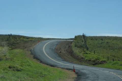
Don’t assume that you can just zoom down the road in a few minutes – be prepared to pull over on the side of the road for random hikes and photo opportunities. There are roads that take you down the side of the cliff, right to the shoreline. (One such road also takes you to the back gate of the Botanical Garden. They have a gate with a gate keeper – you can’t (and shouldn’t try) to sneak in. However, you can get a nice glance at the Gardens – enough to consider paying the price to go in.)
It’s normally open 9am to 5pm, everyday, and is only $15 for adults! It’s approximately 40 acres and contains over 2000 species of tropical plants.
Tropical lily?Botanical Garden
About 1/2 way between Hilo and Honoka’a (which is our final destination on this particular blog) is Laupahoehoe, and I have to tell you – the view is MAJESTIC!! (Especially if you are coming from the Kona-side, through Waimea.)
LaupahoehoeOn our very first trip to Hawaii, we landed on the Kona-side, which is beautiful, but more…dry…and doesn’t smell like greenhouse… and wasn’t exactly as I had imagined Hawaii to be. BUT, as we drove around to the other side (through rolling hills and fields of pear cactus) and then came around this corner and there in front of us was a view of Laupahoehoe, I actually gasped out loud because of it’s beauty!

(This same gasp triggered a …uh… reprimand… from Peter, who was driving, and thought something had jumped in the road – or some other disastrous event which might initiate a “GASP”!)
Laupahoehoe, I thinkAmazing view! Amazing! On my Top 3 on the Island! (The top 3 really are all tied for #1. I can’t really say which is the most spectacular… but, there’s Laupahoehoe, Waipio Valley, and the view of Whittington Park, near South Point, especially coming from Kona.)
Speaking of Waipio Valley, Honoka’a is the Gateway to Waipio Valley.
It’s a cute little weather beaten town, which I love. BUT it’s BIGGEST claim to fame is TEX DRIVE IN!!
Tex Drive-inWhat is so great about Tex Drive-in you wonder? OK! I am not exaggerating when I tell you that they have the world’s GREATEST Malasada! (I confess – I’ve never had them anywhere else, but I am convinced that there is no way that they could be any better than they are here!) They are so good and so appreciated in Hawaii, apparently, there is Malasada Day! (I just learned this, just now.)
Malasadas freshly madeHave you tried Malasada? Wikipedia defines: “a Portuguese confection, made of egg-sized balls of yeast dough that are deep-fried in oil and coated with granulated sugar.” … Basically, they are like… a light airy doughnut, without the hole in the middle, and often filled with something yummy, like strawberry, or chocolate, or lilikoi. Mmmmmmmmm…
Malasada
They make them in the morning, and you really should be there FIRST THING! They open at 6:30am. The earliest I’ve made it there was 9am, and they had already sold out of their most popular flavors.
Not the normal way to eat Malasada
(I found a recipe for “Tex style malasada” on epicurious.com. I’m 100% positive they won’t be as good if you try to make them, but don’t let that discourage you!! I might try, too, because I’m CRAVING THEM now!!)
Not sure what we’ll be talking about next week – I think the North Shore of Hawaii… for now, all I can think about is Malasada!
(Or, I might interrupt my Hawaii theme with a short blog about Global Fest, here in Calgary. I totally forgot I have tickets to go, so it depends – might write something for Wednesday…)

Sunday, August 11, 2013

Hilo…continued…

Rainbow FallsHi’ilawe Falls (and it’s twin, Hakalaoa) are the tallest waterfalls on The Island (not the tallest in the State (Olo’upena Falls, which is 2,953 feet (900 meters), but it is the 138th tallest in the world.

UpRiver from Rainbow FallsNowhere near the tallest (it’s “only” 80 feet tall (24 meters) but estimated to be one of the most photographed waterfalls in the world, is Rainbow Falls (Waiānuenue, which means “Rainbow Water), in Hilo.
Pe'e Pe'e FallsThe Falls is really beautiful, but probably the main reason that it’s photographed so often is because the parking lot goes right up to it, so it’s very easy access.
There’s a nice little walk upriver from the parking lot, and if the water level is lower, you can climb along the rocks shaped and carved by the swirling water.
Nearby, are The Boiling Pots and Pe’e Pe’e Falls.
First of all, it’s pronounced something like: ”Pay-ay Pay ay”, just so you know.
Fed by the Wailuku River, Pe’e Pe’e Falls is runs along, finding its way through and around old lava tubes, creating rapids and careening through pools that make the water look like it’s boiling.
No SwimmingWhich brings me to the “second of all”: the Boiling Pots aren’t hot – they are more “roiling” than “boiling”. (Just thought I’d clarify, since there’s so much volcanic activity – thought it could be a surprise to find out that the water is cold.)
There are warning signs and swimming is not allowed… that being said, the first day I went, I witnessed this:
Boiling Pots

TERRIBLE Idea – but people do it. There’s a bunch of things to keep in mind (in an effort to talk you out of it): Depth of the water (or lack of depth), speed of water, the fact that this pool dumps over a steep cliff immediately, into another deep, fast-moving, pool, and the fact that there’s more than one ledge you have to clear, even before you hit the water…
My Cronies meal
We always kick off our Hilo-visit with a trip for lunch at Cronies Bar and Grill - I get popcorn shrimp and a Hilo Hula drink every time. I’m always really hopeful that someone else will order their Bucket of Onion Rings, and then be willing to share, because they are SO GOOD!!
Cronies is right on the main strip alongside the wharf, near the farmers market, the Kava bar, and Cafe Pesto.
Cafe Pesto is YUMMY! And entirely different atmosphere than Cronies – they serve such foods as Smoked Salmon Pizzette, Wild green salad, and chicken and wild mushroom risotto. (I think that’s what I had – can’t find my pictures…)
Kava BarAwa Juice

If you go to Hilo at the right time of the year (April), you should go to the Merrie Monarch Festival.
Merrie Monarch Exhibition
The Festival is a week long, celebrating Hawaiian arts and culture. It includes art exhibits, performances, a parade! and a 3 day hula competition! Tickets to the Competition are hard to come by (and by “hard to come by”, I mean “almost impossible”), but there is also one day that is a hula exhibition that is free to the public.
However, it’s so popular, you have to line up hours in advance (we, fortunately, had a friend who was willing to sacrifice his day to stand in line – thank you Don), and then hope that you can get in! (There’s limited space, so chances are – you could stand in line and still not get in…)
The seats are REALLY uncomfortable (concrete bleachers), and the show is really, really long, so maybe bring a pillow or something to sit on. (I was sad we couldn’t stay till the end…. no pillows… next time!)
Merrie Monarch Exhibition 1Merrie Monarch Exhibition 2
If you meander down Kalanianaole Avenue (starting at Ponds Hilo Restaurant), there are many snorkelling and kayaking and beach opportunities – we’ve only driven by, but will eventually give some of the places a try. We were told to go to Richardson Beach Park, but there’s also Leleiwi Park, Wai O’lena Beach Park, Carlsmith Beach Park, Kealoha Beach Park, Onekahakaha Beach Park, Reeds Bay Beach Co Park, and Keaukaha Beach Park… Seems like a good selection!
Ponds Entertainment
Almond Joy maybe?Ponds Hilo ”Restaurant on the Edge” is on the corner of Kalanianaole Avenue and Banyan Drive, which I discussed in my last Hilo blog. For years, I’ve been wanting to go there for dinner, and finally made it this year! Not only was the food DELICIOUS!! but they also had live entertainment – jazz, the night we were there.
Tiger Shrimp Fettucini
Kalanianaole AveCheck out Hilo – I think you’ll love it!
Next week, Hamakua Coast.

Sunday, August 4, 2013

Waipio Valley

Waipio Valley OverlookI found a painting of a beautiful waterfall, and the Gallery Owner told me that it was Hi’ilawe Falls!

Hi’ilawe Stream empties into the Pacific Ocean right in Waipio Valley.
Waipio Valley is, in my opinion, THE most picturesque place on the entire Island!
You can see the most Amazing VIEW right from the top at the Overlook Point…which is the easiest option…
The steep cliffs are about 2000 feet (610 meters) above the Valley floor, so going IN to the Valley is complicated!
You can either:
Hi'ilawe River1) drive in – which is the scariest option! You are not allowed to take in a rental vehicle, and the vehicle must be a 4 wheel drive with low low low gear.
On your way down the hill, you must yield to upcoming traffic – if they have to shift, they can possibly roll off the cliff.  When you look over the edge of the cliff into the trees, you will see carcasses of vehicles that didn’t quite make it.   Also, don’t wear your seatbelt, in case you have to jump out!
When the road in is classified as “a road”, it is the steepest road of it’s length in the United States, and maybe even then entire world (says Wikipedia), gaining “800 vertical feet (243.84 m) in 0.6 miles (0.9 km) at a 25% average grade”.
2) take a tour, which will take you in by van, recreational vehicle, or donkey
3) make friends with a Local, who knows how to drive in AND/OR who is ok with abandoning their vehicle
4) hike – which isn’t as easy as it seems. It’s so steep, it’s recommended that if you do hike in, you leave enough recuperation time before you climb back out…
Wild HorsesWe  went in by “Local”.  My brother, who had been down into the Valley at least once, and who didn’t mind abandoning his vehicle – in fact, seemed like that’d be part of the great adventure!
We arrived safely at the bottom of the Valley right where Hi’ilawe Stream empties into the Pacific Ocean, after meandering through the Valley, towards the Black Sand Beach at it’s mouth.  (On the way out, we were propped up in the bed of his little pick-up truck, and it’s seriously so steep, I was practically standing against the tailgate to keep from sliding out!  For us, that’s the only option.  There’s no way I’m hiking in.)
Tiny Girl in the Land of GiantsThere, we were surrounded by gigantic trees, with “wild” horses grazing here and there - I say “wild” because I don’t think they are owned by anyone, but they have perfect manes, so I can’t be sure. (I was TOLD they were wild, though.)
Waipio Valley is called “The Valley of the Kings” and was the home to King Kamehameha I and other royalty once upon a time.
Pink Mountain Apple?So, remember we wanted to find Hi’ilawe Falls, and didn’t realize there was a path, so we decided the best option was to go straight up the Hi’ilawe Stream.  (This was a good idea in theory, and worked out well – but some of the Locals were keeping an eye on us to make sure we were safe (we didn’t realize this until we were safely out of the canyon) because of flash-flood warnings…)
Anyway, for the most part, we were in the Stream and once in awhile, when it was too deep or the rocks were too big to climb over, we hiked right beside the River, through giant blades of grass (could be Ginger or something besides Grass, but I liked feeling like I was a tiny person in the Land of Giants), and over fairy-tale-like pink carpeting (which I’ve since learned was, I think, Mountain Apple (Hawaiian name is possibly ”Ohia’ai”).
It was a beautiful hike!
Hi'ilawe Falls 2Hi’ilawe Falls was impressive – it’s such a tall waterfall, it makes white capped waves when it hits it’s pool.  It’s two tiered and (apparently-reports vary) the first tier is in the 200 foot range, and the main tier drops 1400 feet!!  (Some reports say 1400 in total, and some say it’s 1600 in total… doesn’t seem like that should be that difficult to confirm…)
There’s a second (“twin”) waterfall called “Hakalaoa”, which dries up on occasion, but yay! for us! we got to see THREE waterfalls that day!
Either way, it’s REALLY magnificent!
Hi'ilawe FallsHi'ilawe Falls 3Hi'ilawe Falls 4
Next week, hopefully, back to Hilo.

Saturday, August 3, 2013

Hilo

Hilo Side LushnessOK. So, there is a big rivalry between Hilo-side of the Island and Kona-side of the Island.
If you ask a Kona-side person what they think of Hilo, they will typically say things like:  “It rains too much.”  ”They have coqui frogs.” ”There’s no place to surf/swim/snorkel.”
If you ask a Hilo-side person what they think of Kona, they will typically say things like: “Kona? Pfft.”
We love both sides for different reasons. I will talk more about why we love Kona later. (The primary reason is that we have really wonderful friends there, and that always makes a difference, doesn’t it.)
Rainbow FallsBut, some of the reasons that we LOVE LOVE LOVE Hilo side is that:

1) It rains. I don’t want to say “too much”, but it rains enough to make it lush and smell like a greenhouse. It has amazing waterfalls, vines, rainforests. And, I’m sure locals would tell me otherwise (they always do), but I haven’t seen it rain “too much”. The last time we were there (2 weeks), it rained every single morning – poured, actually. But, around noon, the sun came out and it go really warm, and then the next morning (or sometime throughout the night) the rain would come and cool down the earth again. For me, that’s perfect.

2) There are coqui frogs. I love them! I do! I’m sorry to all you coqui frog haters, but I love them! Sure, they are a little noisy (see previous blog), but if you think of them as “singing a song in chorus” rather than “screeching at 90 decibel”, I think you’d love them too! (and, if you can’t make them into “white noise” when you sleep, where earplugs and/or get a sound machine.)

3) There are MANY places to swim/snorkel/surf - they just are a bit off the beaten path and not near as crowded… (There’s more, too, than just that link I’ve included – they may or may not show up in my future blogs (or this one) but 1/2 the fun is finding these places by yourself.
Tom, the Chicken GuyBut the REAL reason I love Hilo-side, is because of the “Locals.”  “Locals” include actual Hawaiian people, as well as (by way of my definition) people who are not tourists.  “Tourists” (by way of my definition) are those people who are travelling (obviously) OR people who’ve moved there, but haven’t really become part of the culture yet.
For example, I consider Tom, the Chicken Guy, to be a “local.”  Or, a little boy we saw at the beach, who, it seems, lives outside, and looks exactly like I would imagine Tom Sawyer looked – white blonde hair, lightly tanned skin with freckles, and no shoes.
Here’s another difference I’ve observed between Kona-side and Hilo-side.  Kona-side, you can pick out tourists because they are pale(r) than the residence.  Hilo-side, you can pick out tourists because they are tan(ner) than the residence.  (Not because of the amount of time that the sun is available, but because the Hilo-side has an abundance of people who wear hats and avoid full exposure to the sun.  Lots of – ummm – organic people on the Hilo-side. Heh! I love it!)
Hawaiian Hilo HotelI will concede that there is more obviously touristy things to do on the Kona side (again, will discuss those later – if you are going to Kona before I get to that blog, please feel free to email me for suggestions), not including the most photographed waterfall in the world (in Hilo) and the longest erupting volcano in the world (south of Hilo at Hawaii Volcano National Park.)
There are very few hotels in Hilo, and the only one I’ve ever stayed at is the Hilo Hawaiian Hotel, right on Banyan Drive, and beside the Queen Liliuokalani Gardens. (We usually rent a Vacation Rental by Owner.
Babe Ruth's treeBanyan Drive is known as “Hilo Walk of Fame”, because the Banyan trees along the drive have all been planted by celebrities, including trees planted by Babe Ruth, Amelia Earhart, former U.S. Presidents Franklin D. Roosevelt & Richard Nixon, Dr. Thomas Jaggar, and others.  It’s an interesting walk, and just across the street is an ice cream and shave ice stand, so you can have a little break, too – especially if it’s hot out.
Queen Liliukalani GardenThe Queen Liliuokalani Gardens was named after Hawaii’s last reigning monarch, and dedicated in 1917, the same year the Queen died.  dedicated in 1917, the same year the Queen died.  (Her full name was Lydia Liliʻu Loloku Walania Wewehi Kamakaʻeha.)
The Garden is beautiful and last time we were there, we found a paintbrush in one of the trees.  You can just imagine someone spending the day, perched in a mango tree, painting the scenery below.  Perfect.
So…I have a LOT more to say about Hilo.  I haven’t really gotten started.. But, I have a tiny complication, which I will explain in a couple of weeks, so, I will have to return to this area later.  Hilo – to be continued…sometime.
In the meantime, next Sunday, I will be talking about some of the waterfalls.

Sunday, July 21, 2013

Holualoa, Cloud 9, and Saddle Road

Holualoa CafeWho wouldn’t LOVE to go for a Coffee and Art Stroll? Now that I know there IS one, I might plan an entire trip around it!
That’s one of the many things Holualoa has to offer – looks like the first Saturday of November. Apparently, each shop in town (which is almost certainly an art gallery of some sort, whether it’s paintings or woodwork or quilt-type things) hosts a coffee from one of the (more than) 30 Kona coffee farms.
It is a fun, quirky, cute little town (well, it’s not as “little” as I thought – apparently, according to the 2000 Census, there were over 6100 that lived there) – one of my two (maybe three) favorites on the Island (so far).
You can park and walk from end to end of the main street, stopping in at this Gallery or that Gallery, have a break at this coffee shop or that restaurant.
Cat Sleeping @ Kona HotelPink Hotel (Kona Hotel)
There’s an iconic pink hotel that completely represents the friendly, relaxed atmosphere of the town. We stopped in one time, to take a look around. There was nobody at the front desk. There was someone asleep in the rocking chair, watching the TV in the reception area, and a cat sleeping on the other rocking chair. (Nobody came, and we tiptoed out.) I didn’t take many pictures, but I’ve filed the memory away for safe keeping.
It’s better if you make an afternoon of visiting Holualoa - don’t rush through.
Right before you get into Holualoa Village (if you are coming from Kealakekua), you will pass a little wooden shop, Kimura Lauhala Shop , with a wooden boardwalk (at least that’s how I remember it), and filled with shoes and hats and bags made of Lauhala (pandanus leaf). The little shoes (slippahs) are very durable and I’ve had mine for years! (They even lasted through a teething puppy.)
Kimura Lauhala shop
We had the opportunity to talk with the ladies who make the hats (which, by the way, are very intricate and delicate – not just like a typical woven leafed hat), and their art has been handed down, from generation to generation. Unfortunately, they don’t have anyone to whom to hand down their art… :( (At least when we talked with them – maybe that has changed by now, hopefully.)
I didn’t buy a hat (or take pictures), but I have a couple sets of the slippahs.
Eucalyptus Trees at Intersection
Passing straight on through, and out the other side of Holualoa, you will go down a very scenic drive, with a very winding road through coffee plantations. If you go at the right time of day, you might even be able to stop at a shop or two along the way for samples.
Eventually, you come to an intersection where you can go down the hill to Kailua-Kona, or up the hill towards Waimea.
Be sure to take a look at the Painted (well, Rainbow) Eucalyptus trees there, before you proceed. My picture isn’t great (but it does show the particular Eucalyptus Grove…I’m including another picture I took in a different place on the Island, just so you can see how pretty they are!!) Apparently, they are the only Eucalyptus to grow in the Northern Hemisphere AND the most colorful trees in the world!
Eucalyptus Trees on the Big IslandWe are going up the hill towards Waimea.
Hiking the Cloud Forest
Just about a mile up the hill is the turn off, onto Kaloko Drive, to go to Cloud 9.
Really!
I don’t know exactly where, but you can get out and walk around in the Tropical Gardens of the Kona Cloud Forest. It’s a beautiful walk with moss-covered trees, and native tropical plants. Unlike a Rain Forest, which receives it’s precipitation from Rain, the Cloud forest receives 40% of it’s precipitation from – guess where! yep! Clouds & Mist!
Top of Cloud forestRoad up through the Cloud Forest
Pear CactusContinuing up the winding and fairly steep Kaloko Dr. (and perhaps Hao Street, says Google-maps), you will start passing addresses: Cloud #7, Cloud #8 – Cloud #9 (the ideal address), and on up! I forget how many “Clouds” there are, but it seems to me that we got to at least Cloud #14.
This grey cloudy picture is a view from the top of the Cloud Forest road, looking back down to the shoreline. I guess seeing the shoreline is rare since normally, it’s completely clouded in!
Down at the bottom the hill, and continuing uphill toward Waimea, you will probably be surprised by the scenery. It’s rolling hills and tall waving grass, and cattle ranches, and pear cactus! Yes, in Hawaii – cactus.
There’s also Hawaii-typical scenery, too - The Ocean, for example, and Cinder Cones.
After driving about 30 miles (from the Cloud Forest road), you will get to Saddle Road.
Once upon a time, rental cars were not allowed to take it – the road used to be TERRIBLE and the Pass is high altitude, and not very busy, so if you ever had any car trouble, you’d be stuck.
Old Saddle Road Old Saddle Road 1
NOW, the road is GREAT! And well travelled! It saves about an hour of travel time (at least) from the old route.
Saddle road
Up at the top of Saddle Road (well, it feels like the top – I think it’s actually sort of on the way down the other side), it’s completely barren. It looks like the lava just came through – almost nothing has grown back (probably the high altitude?) and is usally misty and eerie.

Then, suddenly, you emerge, and sometime after that (I always think it’s going to be 10 or 15 minutes, and then it feels like hours), you see the sparkling lights of Hilo, coming through the trees.
Next Sunday, Hilo.
(Normally, as some of you know, I post on Wednesdays and Sundays, but I have a project I need to work on, so, I’ll just be posting on Sundays until probably the end of August. I’ll keep you posted… heh.)