Wednesday, May 8, 2013

Hawaii Volcanoes National Park

Pu'u O'oSpeaking of Volcanos, we spent the day in the Volcano area.
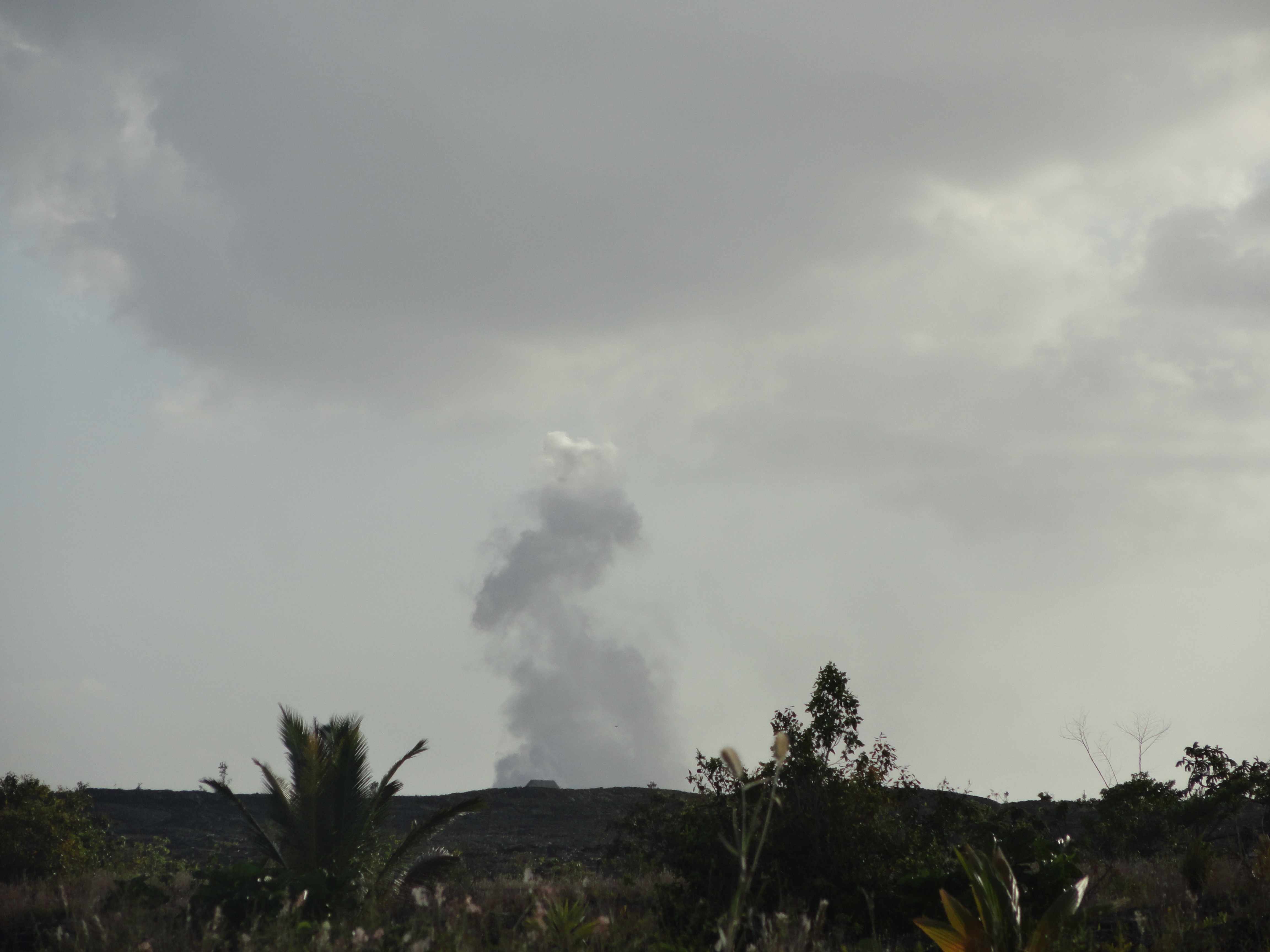
As mentioned, Kilauea is the longest continuous erupting volcano in the world, erupting steadily since 1983. In 1983, it wiped out and buried Kalapana. (I plan to talk about Kalapana on Sunday’s blog…or maybe Wednesday’s…)
Actual Molten LavaThe first time we went was in 1999, and we were able to walk out a couple of miles over the lava fields, from the end of the Chain of Craters Road, and see the red lava flowing down the mountain. You can still do that, apparently, but it’s a longer walk (MUCH longer, by hours and miles), and you need to do a LOT of research to learn where to go and what to take to make the trip safely: enough water, proper shoes, snacks, first aid kits, overnight gear in case you don’t get back in time…) We could’ve walked further out that night and gotten a better view, but I was all in a panic because we didn’t have flashlights…water…snacks… In fact, we ended up finding our way back by using light from those little snap bracelet things that you used to wear at concerts… (In my picture – the one with the bag on my head – the red glow in the background is lava…)
Anyway – it was cool – the lava stream (river?) was still making its way down the hill, so on occasion, we’d see the lava hit and surround a tree and explode like a candle lighting up! really cool.
Now, it’s more of a steady stream, I guess, and sometimes (often?) it’s more underground, so most of the show happens around the point it enters the ocean. There are boat tours that take you around, to see that angle – but the rangers said that even then, you don’t get to see actual hot molten lava. What she actually said was: “Forget what you THINK you SHOULD see and all of your preconceived notions, and be happy with what you DO see.” I thought that was pretty good advice… for everything – not just lava.
Steam BathThe cost to get into Volcano National Park is $10 for your car, but this year, we happened to be there at National Park Week and got in for free!
Once inside the park, there are hours worth of things to see, including random viewpoints along the way, steam vents which feel like a steam sauna when you stand in them, and the Jaggar Museum look out & gift shop.
Steam Vent
Halema'uma'u
From that view-point, you get a really good view of the Halema’uma’u Lava Lake in the Kilauea Crater. AND, if you come back at night, you might get any even BETTER VIEW!!!
Night view againNight view
Inside the museum, there are a lot of fascinating facts, accounts, and discoveries.
Ranger explains Pele's hairWe had walked up to the Museum from a lower parking lot and along the way found long shiny hair-like strings – like…Rapunzel’s hair. Well, the Ranger on site identified them (and had a display) as Pele’s Hair (which…DOES make more sense than Rapunzel’s hair) – tiny fibers of silica fused together into strings – melted strands of glass.
Pele's Hair 2
Thurston Lava TubeAlso worth seeing is the Thurston Lava Tube (Nahuku). A self guided tour, but with a lit pathway through the Tube. A Lava Tube is formed when flowing lava hardens, forming walls and a ceiling. Eventually, the lava stops flowing, and drains out, leaving a cave or a tube. This one is about 600 feet long with a ceiling height of about 20 feet high ~ comfortable for walking and roomy.
Thurston's Lava Tube
One trip, we went in after the Park had technically closed (the Park is open 24 hours, but the Visitor’s Center closes at 5pm and the Museum closes at 7:30pm.) The Tube, at night, is just like it is during the day – a dark tunnel with lights.
Dark and creepyHOWEVER, walking to the tunnel (which is about 1/3 of a mile…20 minutes) at night when nobody else is around and it’s pitch dark is CREEPY!!! It is SO CREEPY, we had 2 teenage boys with us the first time who actually cuddled with their mommy on the way (on the pretense that they were protecting her.) I mean – CREEPY! Big leaves falling in the jungle – croaking and creeking animals (which, by the way, are frogs, mostly – nothing dangerous…technically). BUT, in the middle of the night, cute little frogs and falling leaves transform into the boogie man (the Hawaiian’s have a “boogie-man” legend, but I forget what they call it – anyone know?) and wild ravenous animals.
Thurston Lava Tube at night
IT WAS FUN!!!! If you can handle it, you should try it. (Also, though, go during the day, too, because the walk is beautiful.
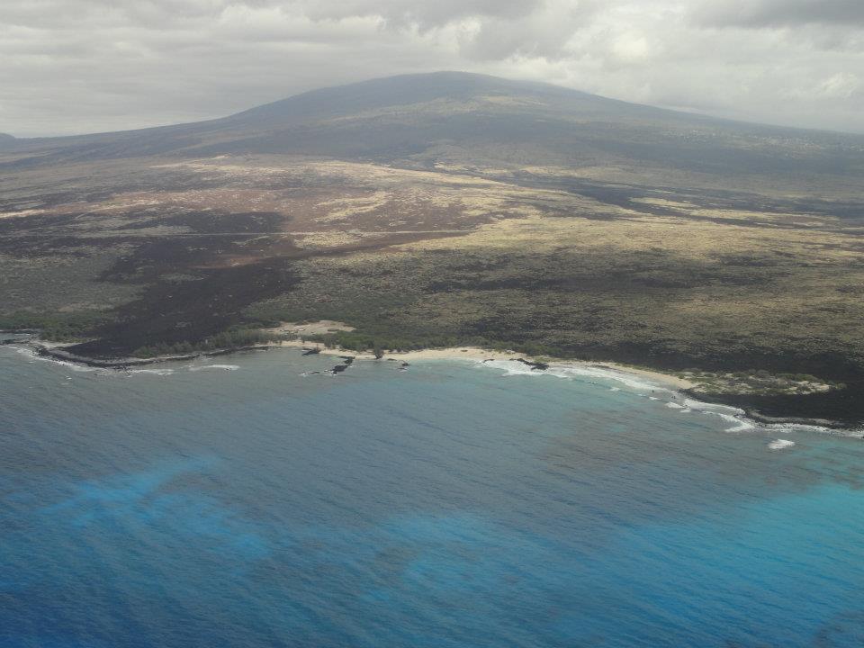
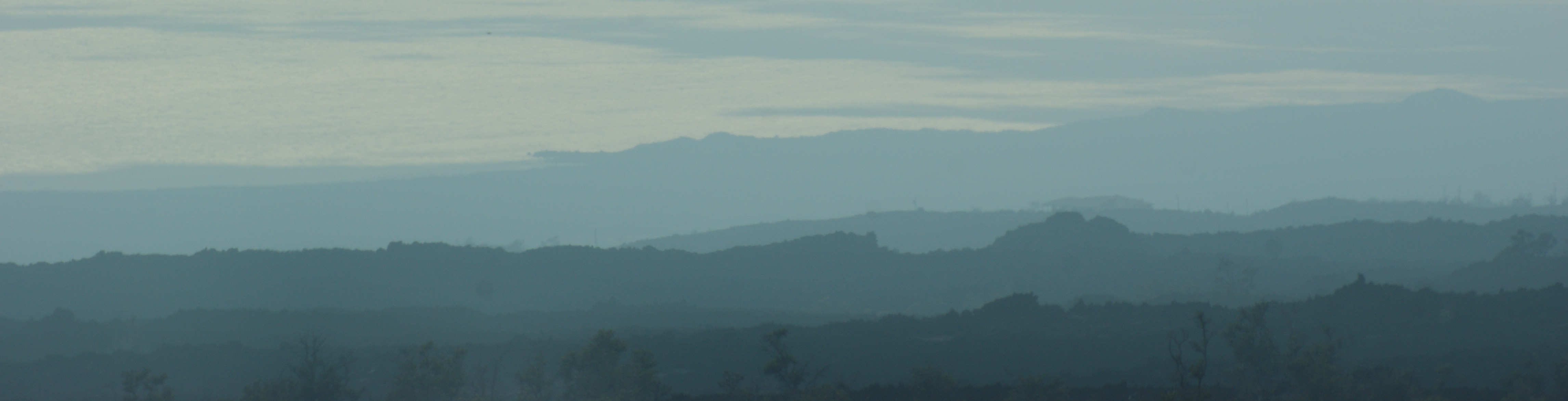
We also took a drive down the Chain of Craters Road – it is a chain of craters :D– we stopped at about 5 maybe – all worth seeing!!
CraterCrater 1
Road to...somewhereThe plan was to get to the end of the Road, to the place where the lava overtook the road… but we got side tracked by a really interesting 9 mile detour, so by the time we got to the end of the Chain of Craters Road, it was too dark… I mean, well – other people were going out, but they were equipped with backpacks, water, flashlights, picnic baskets, and hiking sticks….we had cameras.
Pu'u O'o Vent

Pu'u O'o Vent It was also too late to see the Petroglyphs, which were 0.7 miles from the road, according to the sign. Next time, we’ll have to start there.

Speaking of “next time”, Sunday, we’ll talk more about the Volcano area.

Sunday, May 5, 2013

Hawaii, The BIG Island

Yellow Hibiscus State FlowerI said we were going to talk about Hawaii in this blog, and I thought that was going to be “easy.” BUT, I can’t figure out where to start!!!

Should I start with “Hawaii, the State”? “Hawaii, the Big Island, general information”? I’ve decided to start with “Hawaii, this time around – Day 1.”
 
Going with people who’ve not previously been to Hawaii is always fun for me, because: we get to do things we did the first time we came, but maybe haven’t done since. OR, we get to do things we do every time, but they seem fresh and exciting, because they are fresh and exciting to someone!
 
This particular trip takes place on The Big Island of Hawaii. (Almost all of my trips to Hawaii (state) take place on Hawaii (Island), called “The Big Island” to avoid confusion. Another point that confuses many people is that “The Big Island” is NOT Oahu. Hawaii (The Big Island) is 4,028.2 square miles (2,578,048 acres). Oahu, by comparison, is 727.3 square miles (465,472 acres.)
 
View from KonaIt’s about 95 miles from the North tip to South Point, 80 miles from east to west, and has 266 miles of coastline.
 
Take a look at the map. Without reading labels, you should be able to pick out which island is the Biggest! That’s the one we are visiting.
 
It’s also the youngest. Compared to Oahu’s estimated age of around 3.4 to 2.2 million years old, Big Island is still a keiki (Hawaiian for “child”) at less than 700,000 years old… and still growing. (As we shall see in a later blog.)
 
Kohala maybe?The oldest volcano on The Big Island (there are 5 main volcanic mountains that make up the Island) is Kohala, the northern most mountain. It is estimated to be about a million years old, but reached the surface of the water around 500,000 years ago, and the last estimated eruption was around 120,000 years ago. It’s 5,480 feet (1,670 meters) above sea level, and it’s about 5.8% of the land area of the Island. It is considered “extinct”, which means that it will (supposedly) never erupt again.
 
Hualalai maybe?Mauna Kea is considered “dormant”, which means that it hasn’t erupted in the past 200 years (“historic” times), and probably won’t erupt again.
 
Mauna Kea last erupted around 4,500 years ago. It’s name means “White Mountain” and it often has snow on top. You can even ski and snowboard up there! I think some people even go sledding up there too. I haven’t been up there yet, but it’s definitely on my “to-do” list…well, not to go skiing, I don’t Snowboard postcard

 
think.. it’s REALLY high altitude and often has wind warnings, so timing is tricky.. Plus, I’m not great at skiing and worse at snowboarding… I could maybe sled.. (There’s also caution extended to people who SCUBA, because of the high elevation verses being under the water – something about “the bends”… I guess divers know the restrictions. If not, look it up before you try to SCUBA and summit….Apparently, even if you aren’t diving, altitude-sickness can still be a problem.)


Mauna KeaMauna Kea Mauna Kea is 13,796′ (4205 meter) above sea-level, and the ski hill is at the summit. In fact, Mauna Kea (measured from base to peak) is the tallest mountain on Earth, at 33,476 feet (10,203 meters)!!!! (Mount Everest is 29,035 feet (8,850 meters).. I probably won’t sled. It seems cold. BUT, I’d like to see it.
 
Also up on Mauna Kea is the Onizuka Center for Astronomy (also called Hale Pōhaku, which means “stone house”). They have free stargazing every night! (Yes – this is definitely on my to-do list.) The Center is at 9,300-foot (2,800 m) above sea-level, and it’s suggested/recommended to spend time there to acclimatize, before ascending further.
Hualalai
Hualalai is the Big Island’s oldest ”active” volcano, meaning it has, at some point, in the past 200 years. Hualalai’s last eruption was in 1801.
 
The oldest rocks of Hualalai date back about 128,000, but it’s estimated to have reached the ocean’s surface around 300,000 years ago. It is 8,271 feet (2,521 meters) above sea-level.
 
An eruption is predicted for sometime in the future (in the next 100 years, I read), but is carefully monitored by the Hawaii Volcano Observatory… Hopefully, if anything happens, it’ll be a mild and peaceful eruption… like, a breaking through the surface and a trickling stream down the side…where nobody lives…heh.
 
Mauna Loa means “Long Mountain”. This is a great name! It’s HUGE and has the title of being the “Earth’s Largest Volcano“!! It makes up 50% of the total land base for the Big Island. It’s 60 miles long, 3o miles wide, and 13,681 feet above sea-level. It’s below the ocean’s surface by about 5 kms AND THEN! Because it’s soooo huge and heavy, the sea floor has depressed another 8 kms!! So, technically, it’s summit is around 56,000 feet (17kms) above it’s base!! Yikes!
Mauna Loa 1Mauna Loa
Mauna Loa is estimated to be about 1,000,000 years old, but didn’t reach the ocean’s surface until maybe 400,000 years ago, and the oldest rocks are estimated to be in the 100,000 year range. The last eruption was 1984, and is expected to erupt again…someday.
KilaueaAs discussed, volcano’s are categorized as “Extinct”, “Dormant”, and “Active”. Personally, I have a fourth category: “REALLY Active” – those that are erupting right now! There’s probably an official term anyway, but I didn’t happen across it.
 
“Really Active” is Kilauea, possibly earning the title as “most active” in the world. Although it looks like it’s coming from Mauna Loa, it is actually it’s own volcano. “Kilauea” means “spewing”, which is appropriate since it’s been erupting non-stop since 1983.
 
It’s estimated to be between 300,000 and 600,000 years old, and having reached the ocean’s surface between 50,000 and 100,000 years ago. The oldest rocks date to around 23,000 years old. It is currently 4,190 feet (1,277 meters) above sea-level…the Pu’u O’o Vent (the current erupting point) is a “cinder-and-spatter cone” and lava from it flows through Lava Tubes into the ocean, so it isn’t really gaining height at all, BUT about 500 new acres of land have been added since 1983.
You can see the steam from Pu’u O’o as the lava comes down the mountain and a big plume where it reaches the ocean! Technically, you can hike to get a closer view, but it’s very strenuous and can be dangerous – so do aLOT of research and double check conditions with the Park Rangers at Volcano National Park.
Pu'o O'o
You can also get a pretty good view of the Halema’uma’u Lava Lake right in the Kilauea Crater, from the Jaggar Museum in the Park - it’s kind of at an angle that you can see either steam or the red glow (depending upon the time of day), but not really any liquid lava. They have a web cam, though, too, for an even better view.)
 
Halema'uma'uAn article from October 2012 says that the lava in the Lake had surged about 50 feet (15 meters) and only had about “110 feet (33 m) to go until the lava reaches the top of the vent and floods the crater floor”! (This link has an interesting report from October 2012, plus youtube video.)
 
Wednesday’s blog will be about Kilauea and Volcano National Park. (Oh yes. I’m going to try to get back to a Wednesday/Sunday routine.)
 
Hawaii Mountains
Before I go today, though – I just want to talk about one more active volcano – a “brand new” little up-and-comer – Lo ‘ihi. I’m not sure when it first started erupting, but it reactivated in 1996. It is currently about 931 meters tall on the north side, and 3,786 meters on the south side, since it’s growing on a slope.
 
OK! See you Wednesday!

Sunday, April 28, 2013

Truro’s Tidal Bore and Digby’s Neck, in Nova Scotia

Bird's Eye View of Tidal BoreI talked about the Tidal Bore in my blog about Alaska, but the Truro Tidal Bore, on the Bay of Fundy, is the fastest Tidal Bore in the world!

We were told it was a “must-see”, and when we got there, we were surprised to see people setting up camp, all along the bend in the river – picnics, lawn chairs, beach umbrellas. We were completely unprepared, so were forced to just stand there waiting. (How embarrassing!)

Before 1 Before
Right on schedule, we heard the sound – like a hiss – that grew into a rumble – and then into almost a roar, as the water came.
During !During
You know that movie, Backdraft? about the firefighters – there’s this one part where the fire fighter is talking about how the fire has thoughts and schemes – or something like that… The guy says “It’s a living thing. It breathes, it eats, and it hates. The only way to beat it is to think like it.” That’s EXACTLY how I was feeling about the rushing water! I felt like if I stood too close to the edge, it’d reach out its watery fingers and grab my feet and drag me in!

DuringDuring 1
As I mentioned in the previous blog about the Turnagain Arm Bore in Alaska – the Truro Tidal Bore (one of the fastest in the world) can travel up to 30 miles (48 kms) an hour and can reach up to 20 foot (6 meter) waves!

After1After
Tiverton NS, I thinkAfter we left Truro, we continued our journey to Digby Neck, stopping somewhere along the way, in a little tiny town (maybe it was actually the town of Digby), at McDonalds, where, after waiting about an hour to order (Yes – McDonalds, fast food), we had lobster sandwiches. And, REAL lobster and REAL sandwiches!! Not even shredded or canned, but actual lobster. So yummy! Worth the hour wait. Oh! It’s called a McLobster. Of course!
The Digby Neck is a very narrow peninsula that extends out from Nova Scotia, with St. Mary’s Bay on one side and Bay of Fundy on the other.
The Balancing Rock is actually on the other side of Petit Passage, on Long Island, and is accessible only by ferry.
path to RockSteep Stairs

The Trail to the Balancing Rock is very level and calm, meandering through the forest, until all of the sudden, there’s a STEEP staircase down to the ocean (well, St. Mary’s Bay)! Fortunately, there are benches and landings at which to rest, from time to time. (Don’t forget your inhaler, if you have asthma.)
Balancing Rock 2 
The Rock, made of basalt, is approximately 30 feet tall, and standing straight up from the ledge on which it’s perched!! Apparently, it’s attached by two small sections, but there’s a gap between the sections that you can actually see through to the other side.
Those were the highlights for us! Lighthouses, balancing rocks, tidal bores, and history.
After a few more days, we headed home (on a crookedy little tiny plane so small they could only fire one engine at a time at take-off!) And, thus ends the Adventures in a Disposable Car.
Next week, I think we’ll talk about Hawaii!!

Sunday, April 21, 2013

Lighthouses and Memorials

Peggy's Cove LighthouseIf you love lighthouses, Nova Scotia is the place for you! There are over 160 historical lighthouses scattered along the 7400 km coastline.

In fact, Nova Scotia has the more lighthouses that any other province in Canada… although, really.. is that a surprise? there’s not much competition – most of the country is landlocked.

The oldest working lighthouse in North America is there – 82 feet tall, built in 1758, and located on Sambro Island!

Thinking that’s very old, I Googled to see how 1758 compares to the oldest working lighthouse in the world… and I found the Tower of Hercules, which is an ancient Roman lighthouse built some time late in the 1st century (probably during the reign of Trajan, between 98-117 C.E.), still in use, in north-western Spain….well… 1758 is old too…

Built in 1915 (at “only” almost 100 years old, it’s like it’s brand new!) Peggy’s Cove Lighthouse (or, actually: Peggy’s Point Lighthouse AT Peggy’s Cove) is one of the most photographed lighthouses (in the world?) Perhaps that’s because you can drive right up to it, and it’s only 45 minutes to an hour from Halifax. (Website says an hour, Google maps says 45 minutes… website probably knows best.)
Lost sailors
Worth seeing, there, is the “Fisherman’s Monument“, sculpted in 100 feet of granite, by a Finnish artist named William E. deGarthe. This sculpture depicts the lives of 32 fisherman and their families. I was told, while we were there, that one of the fisherman is actually a self-portrait of the artist. I can’t find anything to support that, now, but I like that it could be true.
 
Also at Peggy’s Cove area is the Memorial for Swissair Flight 111. On 2 September 1998, Swissair 111 crashed into St. Margarets Bay, killing all 229 people (215 passengers and 14 crew members) on board. The flight left from JFK Airport in New York City, and was going to Geneva, Switzerland, but at almost 2 hours inflight, there was trouble. They considered turning and going back to Boston or Bangor, but were informed that Halifax Airport was closer.
 
MemorialAfter trying everything possible, the plane came down, in St. Margarets Bay. At 345 miles per hour, the airplane disintegrated on impact, and everyone died instantly…. Another terrible tragedy for the area.
 
We came across the Memorial while hiking over the gigantic granite rocks. We didn’t know it was there. One of the stones has markings in it ” 1 1 1″ for the flight number, but also, if you look through the markings, they point to the actual crash site.
lighthouse route


I took pictures of 3 or 4 other lighthouses as we travelled the almost-island of Nova Scotia, but I don’t know what they all are called! I will definitely have to consider taking the Historic Lighthouse Tour next time!
 
Go check out the Nova Scotia Lighthouse Preservation Society for a complete list and details for each of their lighthouses.
 
One more Nova Scotia blog next week.